fbpx Skip to main content

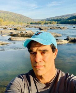
Canal Story #27: Doug Reigner

By Canal Story

To celebrate the 50th anniversary of the C&O Canal becoming a National Historical Park, we are featuring 50 Canal Stories throughout 2021. Each story will take a look at a person’s relationship with the C&O Canal. Whether an NPS ranger, a volunteer, or a visitor, everyone has a story to tell about the canal! If you want to share your story, submit it to us at the link here, email it to us at [email protected] or post it on your social media feeds with the hashtag #MyCanalStory.

Tell Us Your Canal Story

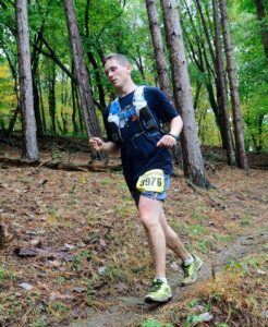
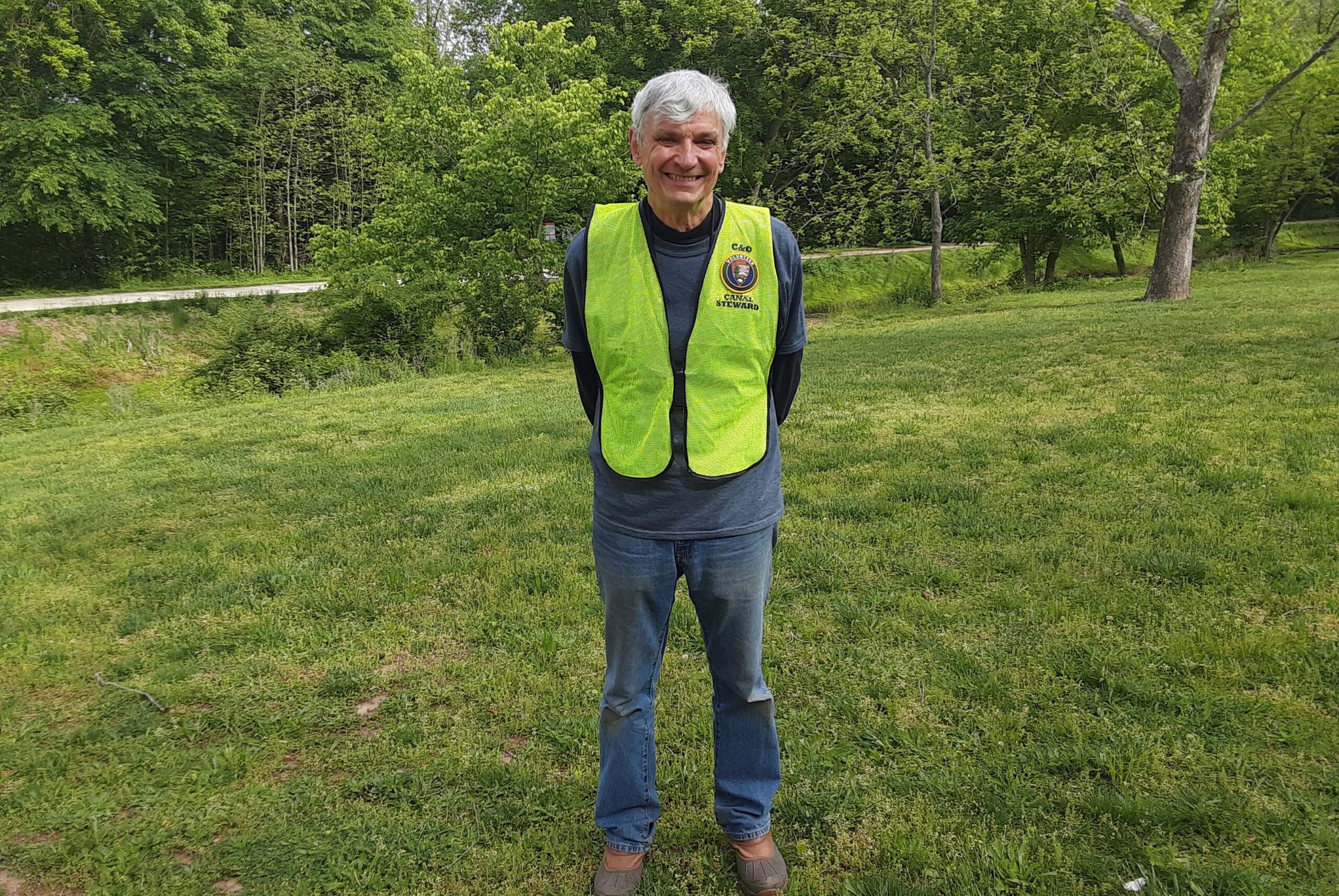
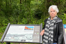
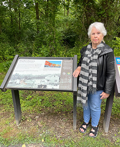
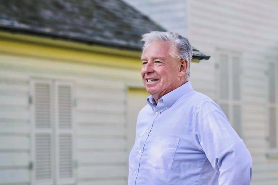
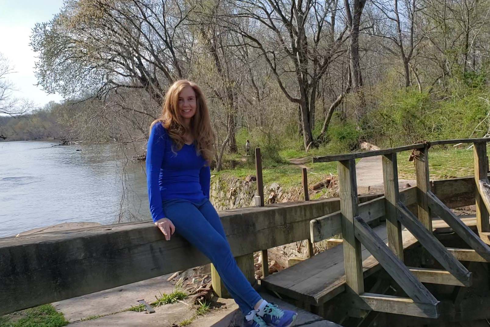
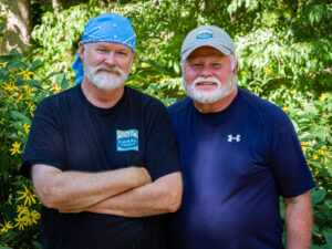
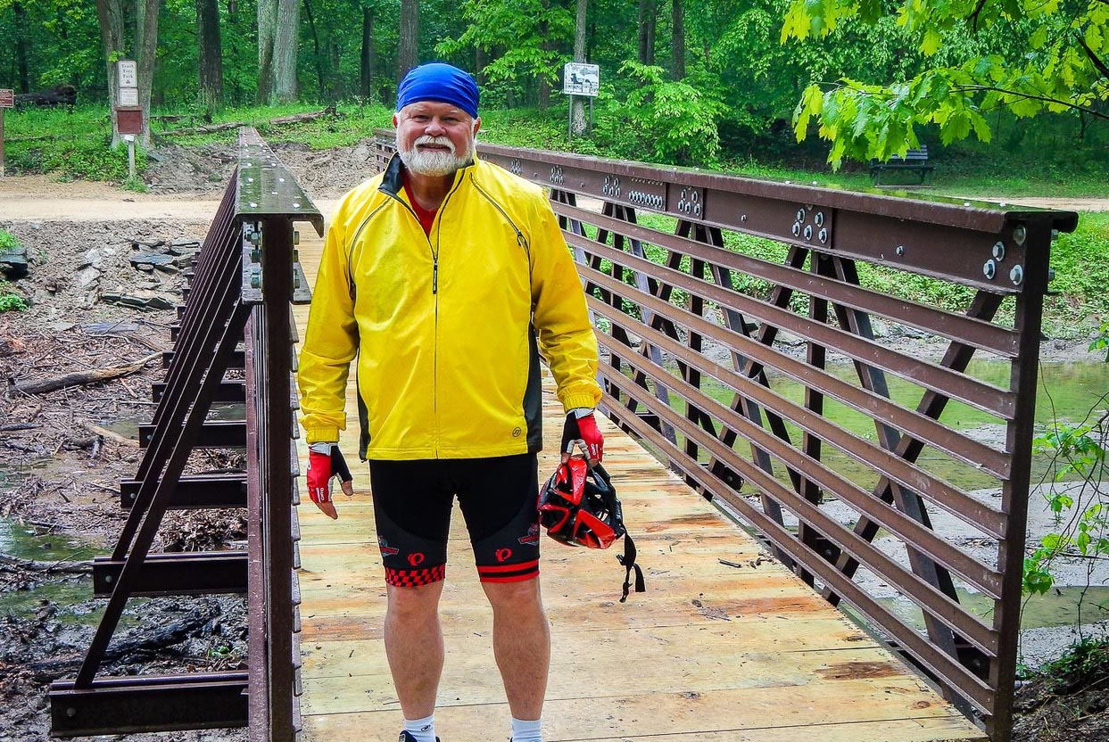
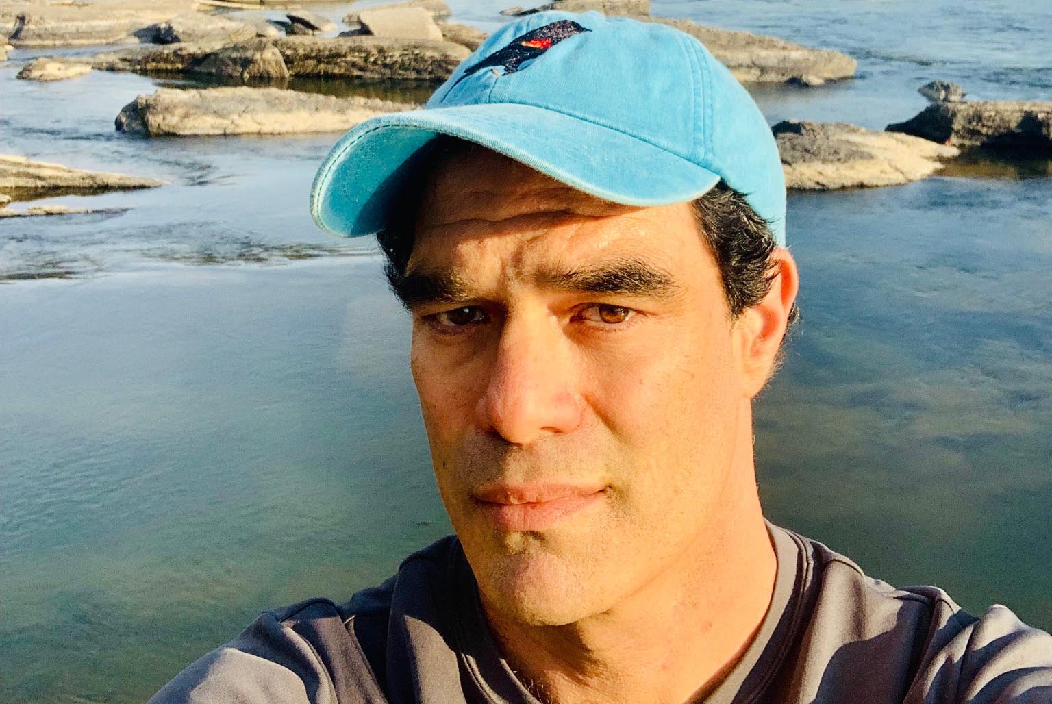
Doug Reigner, Director of Community Relations at the Great Allegheny Passage Conservancy

C&O Canal Trust: What is your history with the C&O Canal?
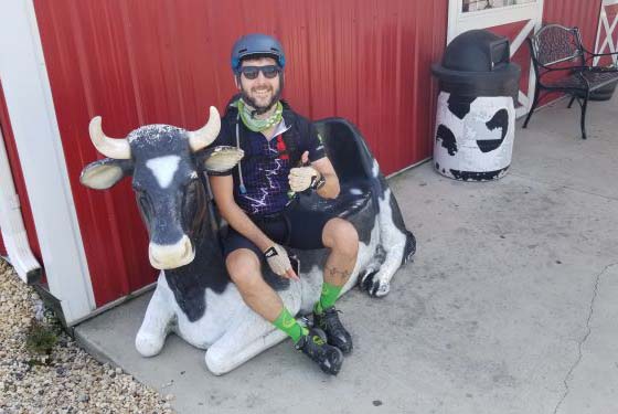
Doug: About 10 years ago a friend wanted to pedal from Pittsburgh to Washington DC.  This is my first memory of researching and planning a visit to the national historic park, the towpath and the learning bits and pieces of the amazing history.  We enjoyed pedaling past and stopping at many of the remnants of old canal and lock houses, the dams, and scenic views of the river.  We visited Hancock, Harpers Ferry and Brunswick that year stopping to eat.  It was such an adventure since it was my first time doing a multi-day travel by bicycle trip.

C&O Canal Trust: During your time volunteering with the Partnership, what is your favorite project you have been a part of?  
Doug: Trails & Rails.  I met Rita Knox, Park Ranger in Cumberland one year.  Rita invited me to check out a Steward program where I’d ride the Amtrak train and engage travelers about the park.  I signed up, drove 90 miles to Cumberland, met a bunch of enthusiastic park rangers and was hooked.  During our training day I met Simon Barber and other great people who knew so much history about the park and nearby towns.  People like Rita and Simon Barber were so inspiring to learn from.  It was never a dull Amtrak ride meeting people, answering questions, giving out park information.

C&O Canal Trust: Do you have a favorite canal memory?  
Doug: Silly but oh so true, my favorite canal memory is going to the Conocacheague aqueduct ribbon cutting ceremony in Williamsport and getting my picture taken with a park mascot who said “Hello Doug.”  I was shocked the mascot knew me.  Turns out it was a dedicated enthusiastic ranger whom I’ve met on several occasions.  That ranger (Ben Helwig) like all the rangers I’ve met over the years are incredible people.  

C&O Canal Trust: What is your favorite spot on the canal?  
Doug: Tough question to answer, I have Favorites-s-s-s-s.  The blue bells blooming near Hancock, the rock wall and river views west of Williamsport, the way the towpath reveals the Potomac river to me every time I pedal towards Harpers Ferry.  Coming out from an otherwise quiet tunnel of towpath trees, I enjoy the explosion of people near Great Falls, then again near Georgetown.  It’s like you’re in a forest then boom you’re in Georgetown!  So many spots come to mind, like I said I have favorites, plural.  Ask me after my next visit through the park and I’ll have more favorites to add to the list.

C&O Canal Trust: What does the canal mean to you?  
Doug: To me the canal means I have a national park within few hours of my home where I can visit a dozen times a year.  There is so much to see and it looks different from sunrise to sunset, from east to west that no matter how many bike rides they are all a little different.  It means I don’t need to race around the country truing to see every park, this one has so much I enjoy seeing it more often! 

Canal Story #26: Clara Thiel

By Canal Story

To celebrate the 50th anniversary of the C&O Canal becoming a National Historical Park, we are featuring 50 Canal Stories throughout 2021. Each story will take a look at a person’s relationship with the C&O Canal. Whether an NPS ranger, a volunteer, or a visitor, everyone has a story to tell about the canal! If you want to share your story, submit it to us at the link here, email it to us at [email protected] or post it on your social media feeds with the hashtag #MyCanalStory.

Tell Us Your Canal Story

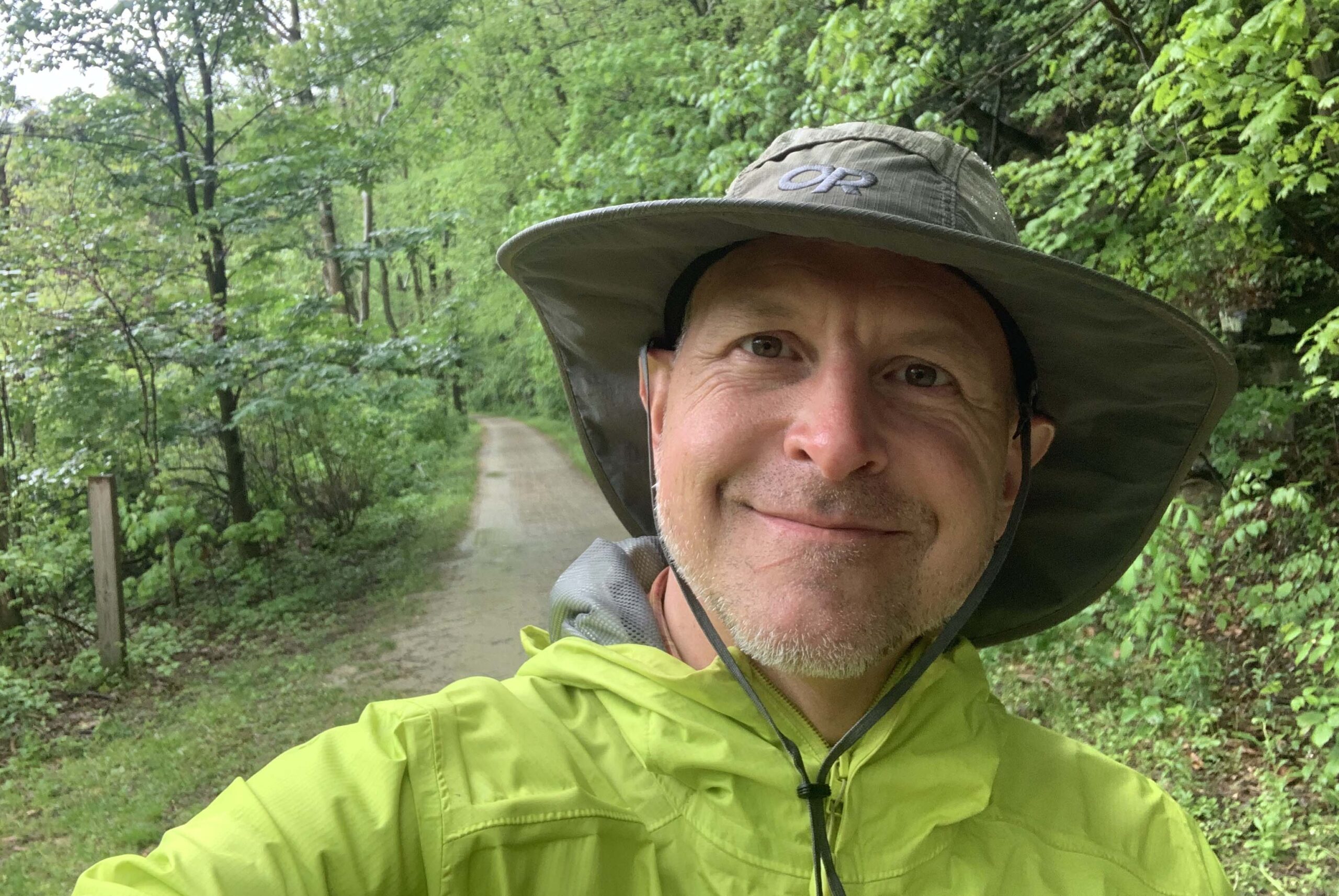
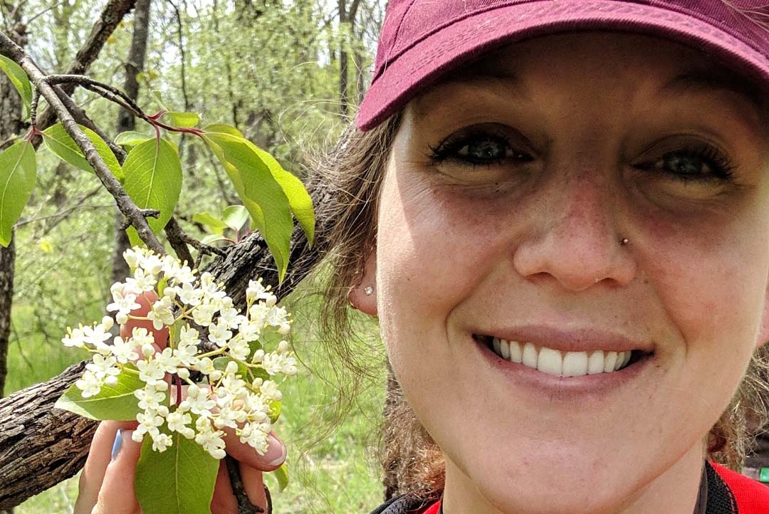
Clara Thiel, C&O Canal Botany Fellow

C&O Canal Trust: What is your relationship with the C&O Canal?
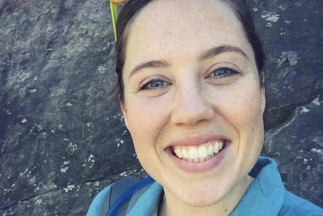
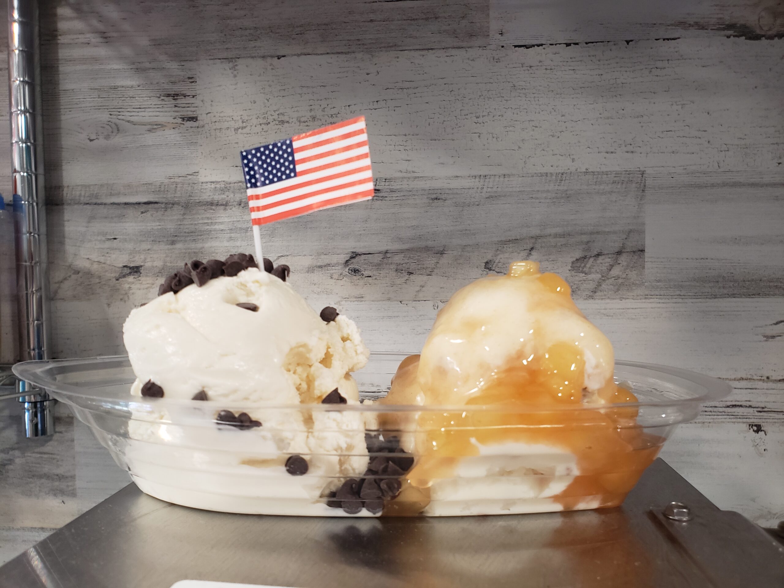
Clara: While growing up in Clarke County, VA, my mom would often take my brother and I to bike on the Canal in the summers, starting in Brunswick and biking to Harpers Ferry for an ice cream treat. I currently live in Knoxville, MD, where my fiancé and I enjoy walking or biking on the Canal with our dogs almost every evening. I am also currently the Botany Fellow for C&O Canal, and focus on studies relating to rare, threatened, and endangered plants along the Potomac River. 

C&O Canal Trust: When and how did you become involved with the C&O Canal / what is your role in the Park?
Clara: In spring 2020 I was offered a brief internship with C&O Canal to assist with surveys of rare, threatened, and endangered plant populations. In March 2021 I began working as the Park’s Botany Fellow and lead the RTE monitoring efforts. 

C&O Canal Trust: What is your favorite part about working with the Park?
Clara: I have really enjoyed seeing the diversity of natural resources that are found within the Park – C&O Canal is so unique! I have learned about so many different plant species and ecosystems, which has inspired me to focus my current research on species adapted to high-stress environments.

C&O Canal Trust: Do you have a favorite plant that you have seen on the canal?
Clara: It’s hard to pick, but some of my favorites are two rare grasses, Melica nitens (three-flowered melic grass) and Melica mutica (two-flowered melic grass). Both of these species produce beautiful, relatively large fruits for grasses, and are restricted to specific soils and rock outcrop communities. 

C&O Canal Trust: Do you have a favorite memory of the Park?
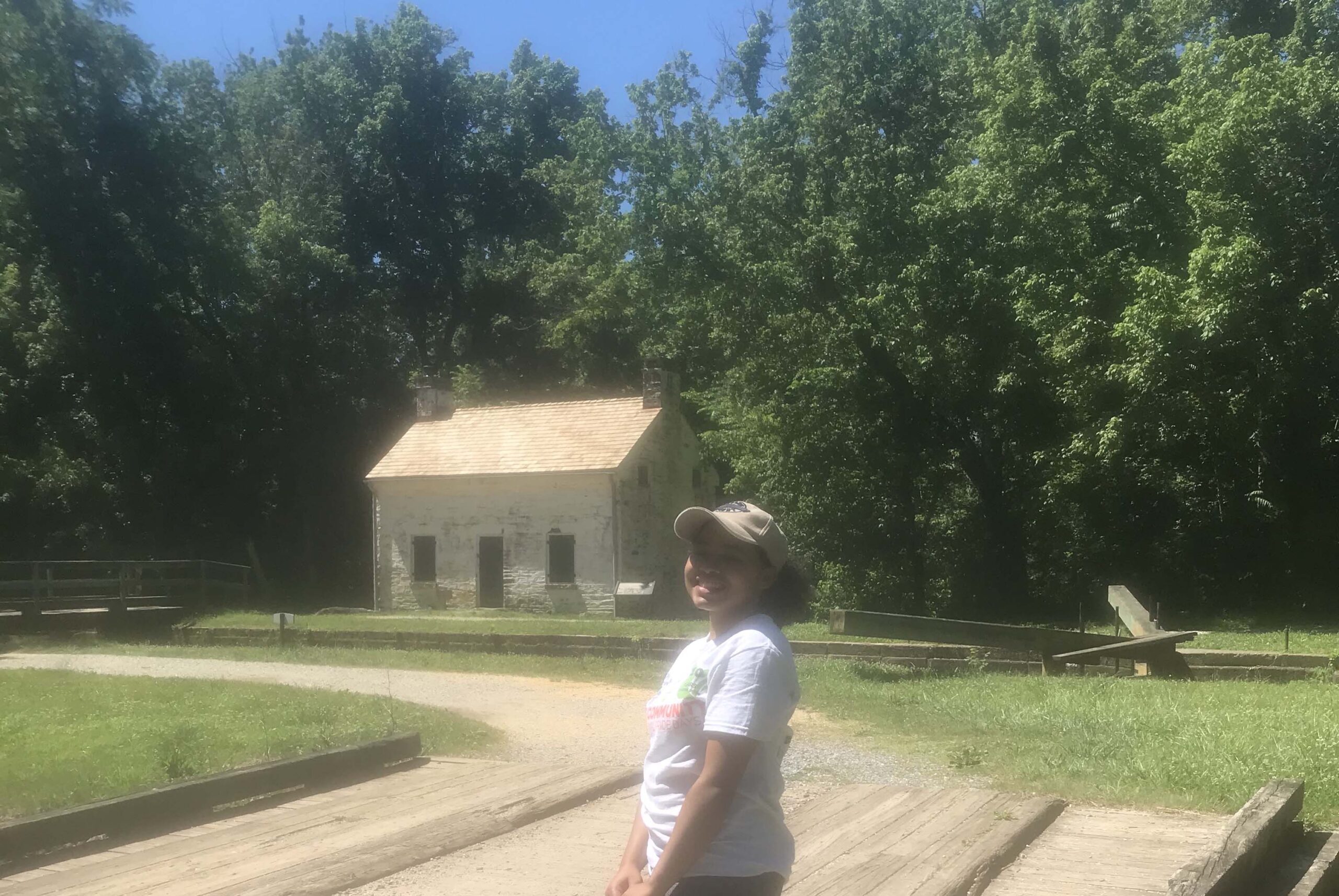
Clara: I have so many to choose from, but my favorite by far is when I got engaged. My boyfriend proposed to me at Lockhouse 75, where we then saw two otters swimming in the canal!

C&O Canal Trust: What is your favorite place or section of the Park?
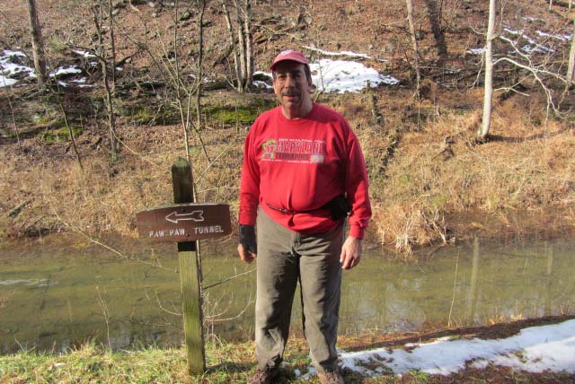
Clara: The Paw Paw bends and Great Falls areas are my favorite places in the Park to work. Both have such unique natural histories and provide high-quality habitat for several rare and interesting plant species. 

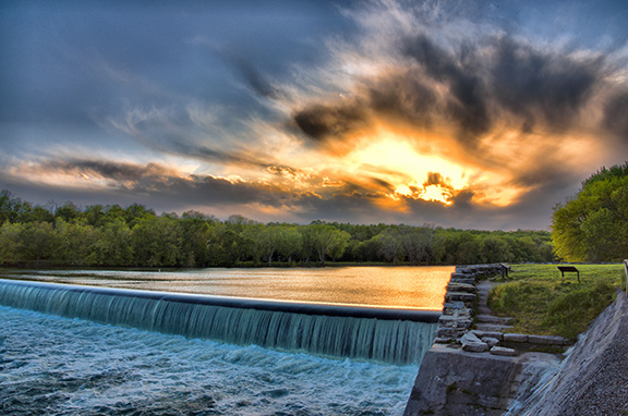
'Sky Fire' at Dam 5 by Margaret J Clingan

Iconic C&O Canal Discoveries: What Not to Miss

By Content

‘Sky Fire’ at Dam 5 by Margaret J Clingan

The C&O Canal National Historical Park is 184.5 miles long — that’s a lot of ground to cover! This itinerary will help you hit the highlights. Explore, learn the history of the canal,  enjoy the stories our Park Rangers most love to share, and deepen your appreciation and understanding of one of America’s great historical parks.

You can also copy this itinerary into our C&O Canal Itinerary Builder here.

East: DC to Brunswick

Mile Marker 0.0           Tide Lock

The Georgetown Tide Lock is the zero milestone terminus on the C&O Canal, and all measurements on the canal were calculated from this point; however, the construction of the canal did not begin here.

Mile Marker 0.4           Douglas Bust

Supreme Court Justice William O. Douglas played an integral part in saving the canal from being turned into a parkway during the 1950s. His love for the canal led him to challenge editors from The Washington Post to hike the entire 184.5 miles of towpath with him to see why the space should be left untouched. His efforts provided a focal point for media attention and intensified the efforts of conservation groups who sought to preserve the canal. Thanks to his efforts, the National Park Service abandoned the parkway idea.

Mile Marker 1.0              Alexandria Aqueduct

An earlier attempt to relieve the congestion of canal boats unloading cargo in Georgetown, the Potomac Aqueduct allowed canal boats to cross over the Potomac River, connect with the Alexandria Canal, and deliver goods to the wharves at Alexandria, Virginia. This structure was built between 1833 and 1843. Only two of the aqueduct’s abutments and one pier near the Virginia shore remain today.

Mile Marker 2.3                  Incline Plane

The Incline Plane was built in 1876 as a way to combat early traffic issues during the heyday of the canal. It lowered boats directly into the Potomac River to avoid boat traffic in Georgetown and delays there. Prior to that, some frustrated boat captains were having to wait two days to get into Georgetown from two miles away because of boat traffic. Since Georgetown was not the final destination for every boat and many just needed to go through Georgetown to access the Potomac River at the tide lock, the incline plane was created to enable boats to bypass Georgetown. A river lock wouldn’t work because the location where the backup occurred was more than 39 feet above the river at low tide. The Potomac Lock and Dock Company proposed the incline plane, which was a caisson into which a boat would float. The boat, encased in the caisson, traveled on the rails of the incline plane from the canal and descended into the river. It was balanced by two counterweights and powered by a turbine supplied with waterpower from the canal. This engineering marvel was the largest of its kind in the world. Unfortunately, it soon became non-essential as transportation on the canal dramatically declined in the following decade. The incline plane was seriously damaged during a flood in 1889 and was never put back into service. Today you can barely make out the incline straight up from the wayside exhibit along the canal.

Mile Marker 3.1             Abner Cloud House and Mill

One of the oldest existing structures on the Canal, the Abner Cloud House dates back to 1801. The site provided grain and excellent quality flour called “Evermay” to Washington, D.C. for nearly 70 years. Only ruins of the mill remain, but the house was restored in the 1970s. Today, the Colonial Dames of America, Chapter III, periodically offers interpretive programs in the house.

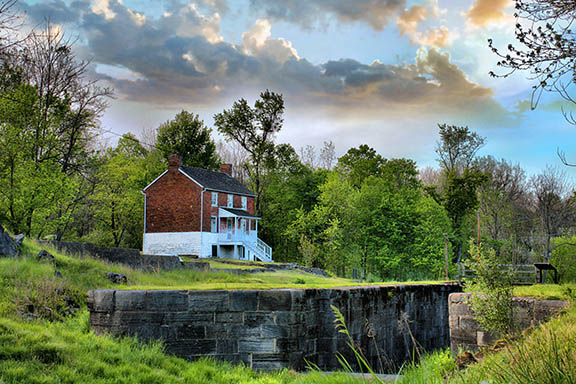
Mile Marker 5.4              Lock 6

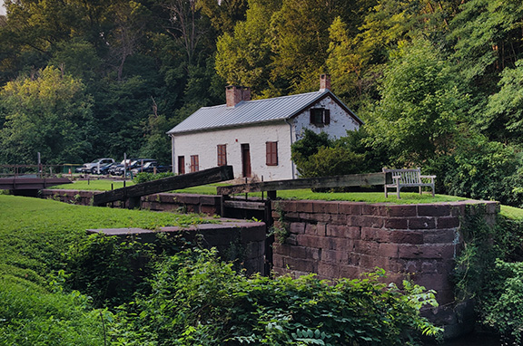
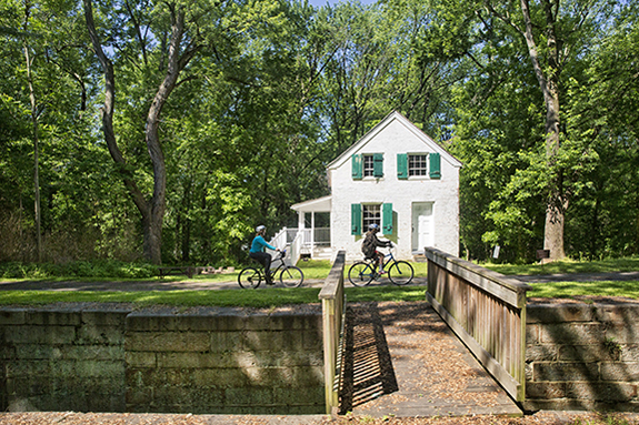
When you happen upon the lockhouse nestled beside Lock 6, you wouldn’t know that this quaint house along the canal had witnessed so much history. Learn about its past and experience life on the canal with an overnight stay at Lockhouse 6, part of the Canal Quarters program. Lockhouse 6 is furnished in the 1950s time period and tells the story of Supreme Court Justice William O. Douglas’s walk of the entire 184.5-mile long towpath to help save the canal. Learn how you can spend the night in this lockhouse here.

Mile Marker 8.8             Lock 10

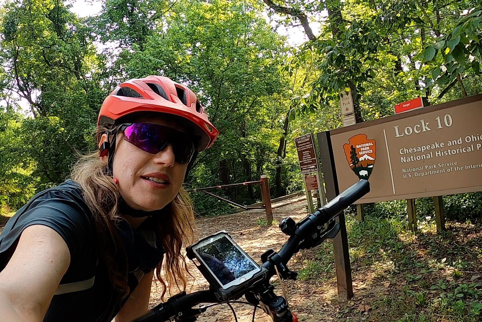
Many canal stories involve the canal’s continuous reinvention of itself. The area surrounding Lock 10 was brought back to life after multiple floods by two African American Civilian Conservation Corps camps. Lockhouse 10, a part of the Canal Quarters program, tells their story. Like Lockhouse 6, it provides a unique lodging option for your canal visit. It is furnished in the 1930s time period and tells the story of the Civilian Conservation Corps (CCC) efforts to preserve the canal. With a screened-in porch overlooking the canal and full amenities, this lockhouse provides a restful spot to recharge from your canal explorations. Learn how you can spend the night in this lockhouse here.

Mile Marker 12.2             Anglers

Located between Billy Goat Trail Sections A and B and just downstream from Widewater is Anglers, one of the most visited sections of the C&O Canal. The natural beauty of Anglers provides the perfect backdrop for walkers, hikers, bikers, kayakers, birders, fishermen, photographers, and painters alike. However, to Canal engineers, Anglers posed a problem: rock. Learn how they have wrestled with the rocky area for over a century. Anglers is now a popular fishing spot.

Mile Marker 12.4       Mather Gorge

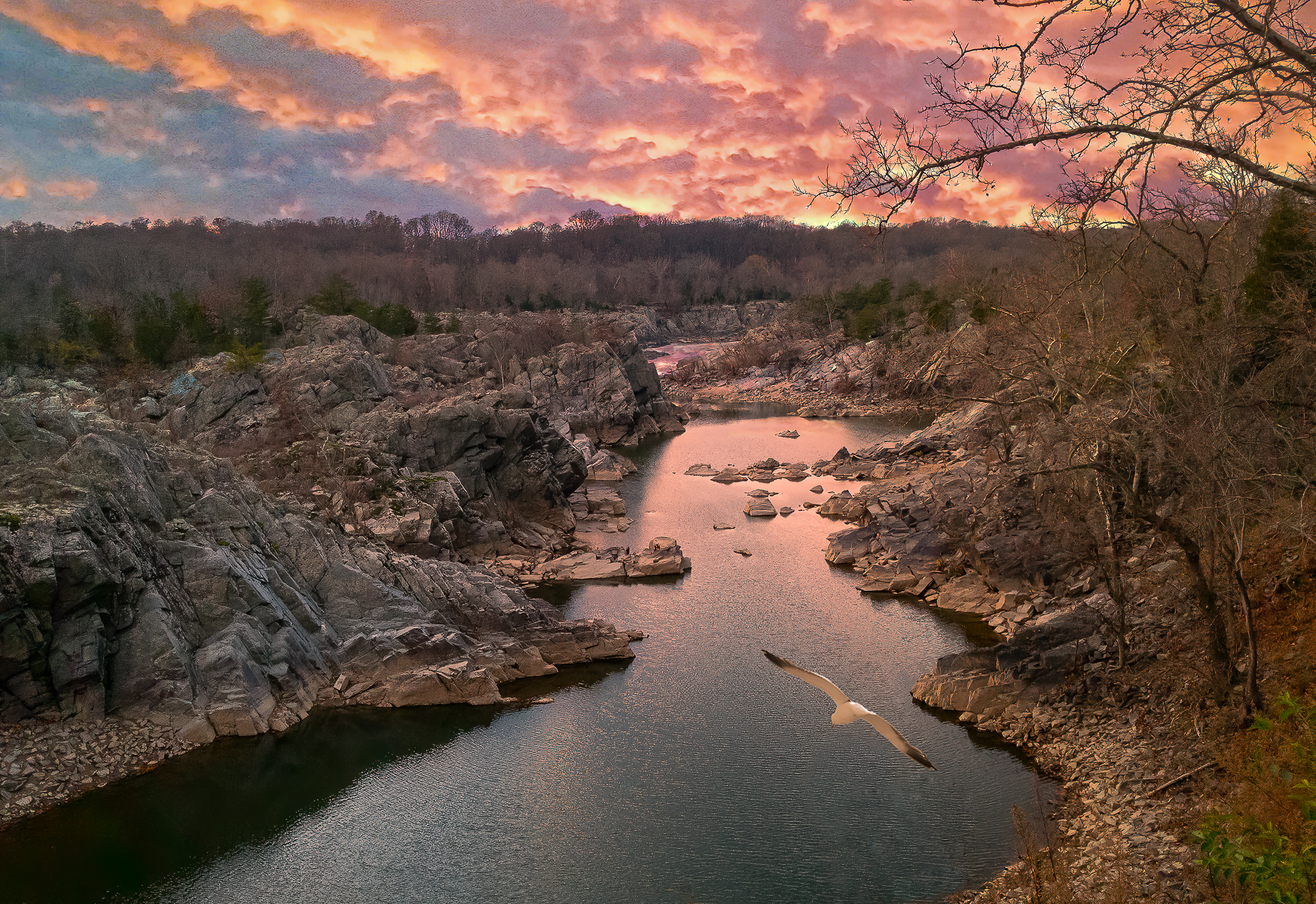
Mather Gorge is part of the Potomac Gorge and lies just downstream from Great Falls. Its sheer cliffs provide a mini-canyon for the wild Potomac River. It is a great place to watch the water bounce off the rocks and for sunrises.

Mile Marker 12.9              Widewater

Located between Great Falls and Anglers, Widewater has a natural wildness to it. It is easy to forget that it is man-made. Although it looks more like a lake, Widewater is part of the Potomac River’s historic path. Canal engineers decided to use this river bed as part of the canal to save on the effort of carving through more rock. Most of the canal is only six feet deep and 60 feet wide, but not Widewater. In some places it is around 50 feet deep and almost 500 feet across. On most days, it is quiet and serene. It is a great place to view the sunrise, bird watch, fish or take a flatwater kayaking trip.

Mile Marker 13.8                 Stop Gate

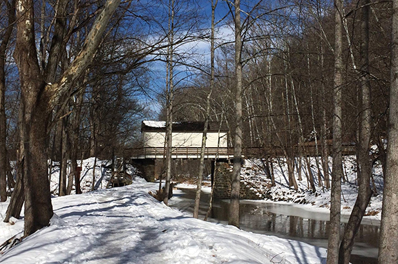
Stop gates were constructed along the C&O Canal to protect the canal, its structures, and communities built around the canal from flood waters. This stop gate was originally built in 1852 and reconstructed with a modern winch system by the National Park Service in 2009. Located not far from the Great Falls Visitor Center, the top portion of the stop gate resembles a covered bridge but it’s actually a winch house. It stores a winch and planks of wood, just a little wider than the foundation. When the river floods, the stop gate is deployed to create a temporary dam that protects the canal downstream. The winch is used to lower the planks, one at a time, through the floor and into grooves that have been cut into both sides of the stone foundation. Some water does pass through, but the majority is stopped from rushing downstream into the canal and causing damage. The use of seven stop gates reduced flood damage and prevented additional devastation throughout the canal’s history.

Mile Marker 14.4                  Great Falls Area

The Great Falls Area is one of the most popular sections of the C&O Canal National Historical Park, with the Historic Great Falls Tavern as its centerpiece. Once known as the Crommelin House, today, the tavern is a visitor center for the Park, offering visitor services, exhibits, interpretive programs, and more. This grand two-story historic structure, completed in 1829, served a number of purposes through the years as a locktender’s house, a tavern, a hotel, and even a private club. You will also find hiking trails and a canal boat ride (see below) at Great Fall, as well as scenic overlooks with dramatic views of the Potomac River thundering over the rocks.

Mile Marker 14.4               Charles F. Mercer Canal Boat

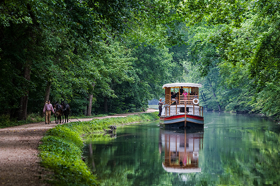
One of the most authentic experiences available on the C&O Canal is a canal boat ride. Experience life in the 1870s, a history lesson and a unique boat ride that includes a ride through a 19th century lock, complete with canal mules and costumed guides. You’ll get all this and more during an hour-long ride aboard the replica Charles F. Mercer canal boat at the Historic Great Falls Tavern. (Check www.nps.gov/choh for the schedule of boat rides. Rides are closed for 2020 and will resume in 2021.)

Mile Marker 14.4             Gold Mine Trails

During the Civil War, a Union soldier was stationed along the Maryland side of the Potomac River near Great Falls. While cleaning up in a creek, he noticed a glint of gold. After the war, he returned to the area, bought some farm land, and started mining for gold in Montgomery County. Eventually, 30 small mines were opened. One of the largest was the Maryland Mine. Today, a loop trail starting at the Great Falls Tavern Visitors Center will take you up past the mine ruins.

Mile Marker 16.7 Lock 21 Swains

The history of Lock 21 and the Swain family will forever be intertwined. Swain family members can be traced back to the original construction of the Canal, and their tradition of service at this lock house extended through the Canal’s most thriving decades and much of the 20th century. Also a part of the Canal Quarters program, Lockhouse 21 is also known as “Swains Lockhouse” after the family. This lockhouse interprets 1916, the year the National Park Service was formed and the date when the C&O Canal was beginning to transition from a working canal to a recreational space. The lockhouse has been completely modernized with full amenities, including an ADA-accessible bathroom and a Murphy bed on the first floor, ramps into the house, and hallways wide enough to accommodate a wheelchair. Learn how you can spend the night in this lockhouse here.

Mile Marker 16.7                    Lock 22 Pennyfield

Located at mile 19.63 on the C&O Canal, Pennyfield Lockhouse at lock number 22 is a quiet place of escape for those seeking from the hectic pace of life in Washington, D.C. In the 1870s, then-President Grover Cleveland would regularly visit Pennyfield in order to pursue his favorite hobby of fishing. You can experience life on the canal with an overnight stay at Lockhouse 22, part of the Canal Quarters program. Lockhouse 22 is furnished in the 1830s time period, reflecting on the early phase of canal construction and the architectural marvels that were necessary to make it functional. Step back in time and experience life as the lock keepers truly lived. Learn how you can spend the night in this lockhouse here.

Mile Marker 22.7                  Lock 24 Rileys Lockhouse and Seneca Aqueduct

Seneca Aqueduct and Lock 24 are combined into a single structure here, the only place along the canal that this was necessary. This is one of 11 aqueducts that carried the canal over major tributaries of the Potomac.

Riley’s Lockhouse is very well restored, with one-and-a-half stories over a full basement. Local Girl Scouts dressed in period clothing periodically provide interpretation and guide visitors through the historic home.

Mile Marker 22.8                  Seneca Stone Cutting Mill

Seneca Stone Cutting Mill operated from 1837 to the early 1900s, milling stone from Seneca Quarry for many structures on the canal and public buildings in Washington, D.C., including the iconic Smithsonian Castle on the National Mall. The mill’s water wheel, and later a turbine, were powered by water from the canal. Seneca Stone Cutting Mill also cut granite and stone shipped from neighboring quarries. Granite and marble used in the U.S. Capitol and the Washington Monument were cut here.

Mile Marker 30.9                  Lock 25 Edwards Ferry

Activity at Edward’s Ferry began very early in the Civil War with a Union encampment and commissary established here. The area continued to be used by both Union and Confederate troops throughout the war. Today, you can experience life on the Canal with an overnight stay at Lockhouse 25, part of the Canal Quarters program. Lockhouse 25 is nestled in the sleepy town of Edwards Ferry and is furnished in the 1860s time period, telling the story of the Civil War’s impact on the Canal. Learn how you can spend the night in this lockhouse here.

Mile Marker 30.9              Ruin of Jarboe’s Store

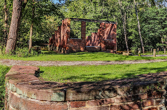
Close to Lock 25 are the brick ruins of Jarboe’s store. During the late 19th century and early 20th century, Eugene E. Jarboe ran a grocery and feed store, while also serving as postmaster at Edward’s Ferry. Gene’s sons, Sam and John, ran the store after their father tragically drowned in the lock while loading cattle. The store closed in 1906, and the NPS re-stabilized the ruins from 2008-2010.

Mile Marker 35.5             White’s Ferry

White’s Ferry is a one-of-a-kind on the Potomac River. Until it closed in 2020, it was the last operating ferry on the river, transporting vehicles, cyclists and pedestrians from Maryland across to the Leesburg area of Virginia. The ferry dates back to the early 1800s and gets its name from former Confederate Lieutenant Colonel Elijah White, who owned a nearby farm and purchased the ferry after the Civil War.

Mile Marker 42.2             Monocacy Aqueduct

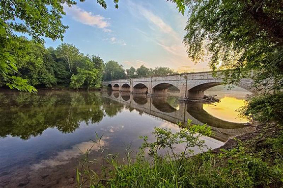
The Monocacy Aqueduct is the largest of the canal’s 11 stone aqueducts. It is often considered one of the two finest features of the C&O Canal. It was built from 1829-1833.

Mile Marker 49.0                  Lock 28

Lockhouse 28 is the most remote of all the Canal Quarters lockhouses, located nearly a half mile from the nearest parking. This rustic retreat was completed in 1837 and is a reminder of the fierce competitive race between the Chesapeake & Ohio Canal and the Baltimore & Ohio Railroad in the race to reach the Ohio River Valley. Learn how you can spend the night in this lockhouse here.

Mile Marker 51.5                Catoctin Aqueduct

The Catoctin Aqueduct is listed on the National Register of Historic Places. It was built with two semi-circle arches on either side of an elliptical arch. The elliptical arch was not structurally strong and began to sag, leading to structural failure. In 1973 two arches collapsed leaving only a remnant of the eastern arch standing. The Park Service buried the original stones to help preserve them in case the aqueduct was ever restored, which began in 2007. The restored aqueduct was dedicated and re-opened in 2011.

Central: Brunswick to Hancock

Mile Marker 62.5          Fort Duncan

The construction of Fort Duncan began in October 1862, shortly after the Battle of Antietam and the surrender of Harpers Ferry to Confederate forces. The mission of the fort was to guard the land surrounding Harpers Ferry and Bolivar Heights, as well as traffic on the Baltimore and Ohio Railroad and Chesapeake and Ohio Canal. Located across from Bolivar Heights, Fort Duncan is the far left flank of the Bernard Line, a series of fortifications along Maryland Heights. Ever vigilant, the only action Fort Duncan saw was a small demonstration following Jubal Early’s raid on Washington in 1864.

Mile Marker 65.2            Shinhan Limestone Kilns

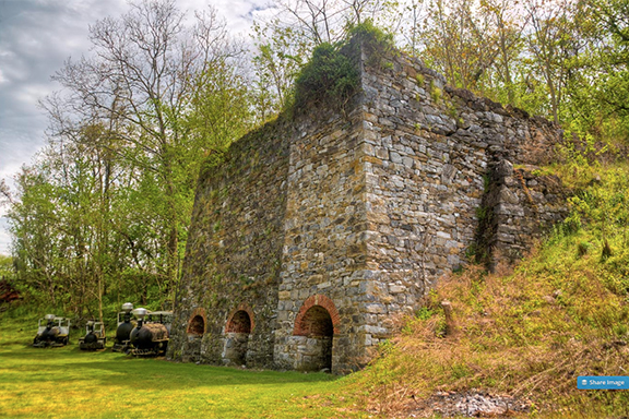
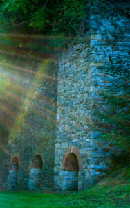
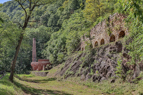
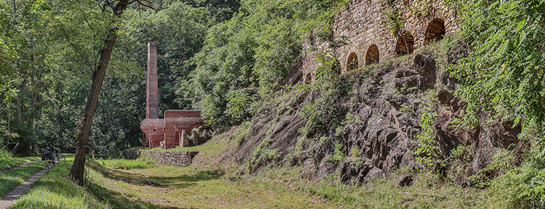
At this point along the Canal, you can observe brick-lined arches in a concrete facing. These are the remains of several limestone kilns that were used to create fertilizer, plaster and cement during the 19th century. Owned by O.J. Shinhan, the kilns were operating as late as the 1960s. Cement was likely not produced here after the turn of the century, however, as Portland cement became the preferred product.

Mile Marker 69.5             Antietam Ironworks

The remnants of the once-thriving village of Antietam and the old limekilns from Antietam Ironworks are just beyond the stone bridge over Antietam Creek. Located at the confluence of Antietam Creek and the Potomac River, this was the site of extensive iron-working facilities for most of the century following 1765. Pig iron was the major product. During the Revolutionary War, craftsmen forged cannons, cast cannon balls, and turned out muskets at Antietam Ironworks. In 1786, metal parts for James Rumsey’s experimental steamboat were forged here. Powered by water from the Antietam Creek, the village had a rolling mill, slitting mill, nail factories, large grist mill, limestone crushing mill, spinning mills, hemp mills, flour mills, sawmill, shingle mill, cooperage factory, woolen mill, and stove works at various times. During the Maryland Campaign of 1862, General Ambrose Burnside’s Ninth Army Corps passed through the village on its way to Sharpsburg. The ironworks suffered some damage during the Civil War but was rebuilt and operated until 1882. Antietam Village and Antietam Ironworks are on the National Register of Historic Places.

Mile Marker 75.7               Killiansburg Cave

After the Battle of South Mountain, as the Confederate army retreated and settled in Sharpsburg, the town residents felt the tension mounting between the Confederates and the Federals. Many families left their homes to go stay with nearby relatives while others found refuge in caves, including the Killiansburg Cave, along the Potomac River. Out of the line of fire, the caves provided a safe haven for residents to gather until the battle ceased.

Mile Marker 84.6             Dam 4

The seven dams on the Potomac River were originally built to divert water into the canal. Dam 4 provided water for 22 miles of the canal, from Milepost 84.6 downstream to Milepost 62.3, just above Harpers Ferry. The water was regulated at the guard lock at Dam 4 to maintain a consistent level of water traveling at two miles per hour down the canal prism. For the past hundred years, Dam 4 has also been capturing the water’s power at a facility on the West Virginia side of the river. This hydro-electric gravity dam, built in 1913 and modified in 1994, is 20 feet tall and approximately 800 feet across. It uses a drive belt to transfer power from the river to the turbines.

Mile Marker 88.1             McMahon’s Mill

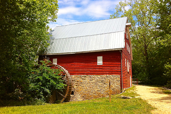
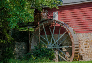
The mill here has been known by a variety of different names: Shanks Mill, Charles Mill (not to be confused with Charles Mill just below Dam 5), Avis Mill, Shaffer’s Mill, Old Flouring Mill, Galloways Mill, Cedar Grove Mill, and more recently, McMahon’s Mill. The mill was built on Downey Branch in 1778 to produce flour, feed, and plaster. The wooden overshot wheel was replaced by a steel wheel in the 1920’s, when waterpower was used to generate electricity here. The mill closed in 1922 after a flood and was later restored by the National Park Service.

Mile Marker 99.1       Lockhouse 44

Although Lockhouse 44 was not built until after the Civl War, the lock itself was operational with a storehouse and mill nearby. How unnerving it must have been here during a canon barrage with the echo of artillery reverberating over the water and through the trees, with tremors shaking both boats and buildings. There was also a constant worry about Confederates disrupting canal operations by raiding the stores, confiscating boats, or blowing up dams or aqueducts. Right here at Lock 44 in 1862, the lock gates were burned along with eleven canal boats. The following year the lock gates were burnt again and part of the lock wall torn down.

Mile Marker 99.5             Bollman Bridge

The Bollman Bridge was constructed in 1879 and stands as a testament to nineteenth century engineering. This pony-Pratt iron truss bridge is one of the few surviving bridges built by Wendell Bollman, a pioneer in engineering of iron bridges. Prior to 1850, most bridges built in America were wooden. Bollman was a self-taught engineer who pioneered the “Bollman truss” design.

Mile Marker 99.5                Cushwa Basin

The historic Cushwa Basin warehouse is open seasonally as the C&O Canal Visitor Center in Williamsport, interpreting the 1920s time period on the canal. The Park staff offer boat tours at Williamsport/Cushwa Basin on a replica launch boat that passes over the refurbished Conococheague Aqueduct. It’s the only place in North America where visitors can see a lift lock and refurbished lockhouse, a railroad lift bridge, a canal turning basin, and a re-watered aqueduct. Lockhouse 44 is fully furnished on the lower level and is open to visitors periodically throughout the spring and summer. Visitors can step back in time to learn about what lock keepers did and how they lived. Inside the Cushwa Basin warehouse visitors will find interpretive exhibits and visitor information. The Trolley Barn at Cushwa Basin features hands-on activities for children and replica historic toys. Days and times may vary for boat tours and visitation to Lockhouse 44 and the Trolley Barn. Visit the Park’s website for more information.

Mile Marker 99.6               Conococheague Aqueduct

Completed in 1834, the Conococheague Aqueduct was built of limestone from nearby quarries. The aqueduct has three equal arch spans. Both armies launched raids against the aqueduct during the Civil War. Years later, the berm wall collapsed early on the morning of April 20, 1920. The boat traveling across the aqueduct fell into the Conococheague Creek and remained there until the 1936 flood carried it down the Potomac. A full restoration of the aqueduct was completed in 2019. Canal launch boat rides across the re-watered aqueduct are offered seasonally. Learn more about the C&O Canal’s aqueducts here.

Mile Marker 106.6          Dam 5/Guard Lock

Originally constructed of timber in 1835, Dam No. 5 was an important source of hydro power for millworks on the river. Unfortunately, the dam’s timber construction was no match for the many floods that swelled the Potomac River. The canal company decided a masonry dam would be stronger, but completion of the new 700-foot “high rock” dam was delayed by more floods and the Civil War. The plant was converted to a paper mill for a short time from 1887-1891, and has been producing electricity since that time by several different power companies.

Mile Marker 108.9          Lock 49 and Four Locks

Unlike many other canal towns, which were founded before the canal began, Four Locks began as private land and developed into a town after the canal came through. Named for the four locks that traverse this quarter mile section, over 30 buildings once stood here, including residences, warehouses, stores, a post office, and a one-room schoolhouse — everything a child and their family would need. Experience life on the Canal with an overnight stay at Lockhouse 49, part of the Canal Quarters program. Lockhouse 49 is a two-story lockhouse furnished in the 1920s time period that tells the story of the Four Locks community. Learn how you can spend the night in this lockhouse here.

Mile Marker 109.0           School House

From 1877 to 1943, the School House at mile marker 109 taught thirty children in eight grades. With no heat, electricity, or indoor plumbing, the School House is a stark comparison to our modern day conveniences. Oil lamps provided light, the pot-bellied stove provided heat, and bathroom trips required venturing outside in the elements. In addition to their studies, children had chores around the School House, such as stacking firewood for the stove and carrying drinking water from a well near the Canal. Of course, eager to get away from school, children would often spill much of the water to be sent back for more.

Mile Marker 110.2             McCoys Ferry

Union and Confederate troops clashed several times at McCoys Ferry throughout the Civil War, On May 23, 1861, Confederate forces tried to capture the ferry boat but were halted by fire from the Clear Spring Guards. They let the boat drift downstream where Union soldiers later retrieved it. On October 10, 1862, less than one month after the Battle of Antietam, Confederate General J.E.B. Stuart and his cavalry crossed the Potomac River at McCoys Ferry on his second ride around McClellan’s army. Part of the Confederate cavalry in the McCausland-Johnson raid crossed the Potomac here on July 24, 1864. The cavalry was on its way to Chambersburg, Pennsylvania, where it burned the town after residents refused to pay a ransom.Mile Marker 112.4

West: Hancock to Cumberland

Mile Marker 127.4              Round Top Cement Mill

When the C&O Canal was being dug in 1837, argillomagenisian limestone, a material well-suited for hydraulic cement, was discovered. George Shafer, who produced cement upstream, opened a cement mill in 1838 at the foot of Roundtop Hill. The mill provided cement for the remaining 60 miles of canal heading west to Cumberland. This mill even supplied cement for the Washington Monument, the Cabin John Bridge, and the U.S. Capitol. In 1863, the mill was sold and renamed the Round Top Hydraulic Cement Company. It quickly became one of Washington County’s most profitable businesses, providing jobs for 100 people during the Civil War. The mill was eventually put out of business by Portland cement, which was stronger and took longer to harden. The cement mill burnt and was rebuilt three times during its operation, including a fire in 1903 that greatly reduced the operation. Today the ruins of the mill and eight kilns, once powered by coal shipped downstream via canal boat, remain.

Mile Marker 154.7          Lock 65:  The Missing Lock

Have you heard of the “missing lock?” Lock No. 65 or the “missing lock” was never really missing at all, only eliminated from the construction plans by the canal company. Learn the full story!

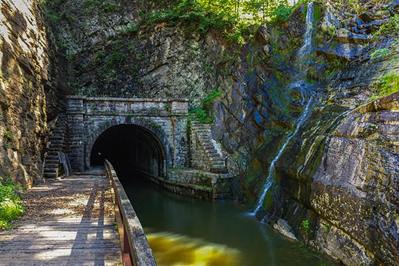
Mile Marker 155.0             Paw Paw Tunnel

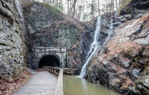
It took 12 years and nearly all of the Canal Company’s funds to complete the Paw Paw Tunnel, but it opened to traffic on October 10, 1850. The tunnel was built to save five miles of construction by cutting across a neck of land formed by the Paw Paw bends. What resulted was the most notable landmark on the Canal—at three-fifths of a mile and 5,800,000 bricks in all.

Mile Marker 166.7          Michael Cresap House

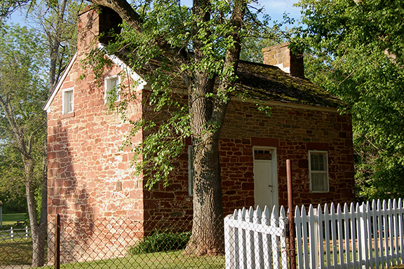
Built in 1762, Thomas Cresap with his 20-year-old son Michael built this house. Michael died 13 years later, but Thomas lived into his nineties. The house is one of the only remnants of the frontier the Cresap family built in Oldtown. Reverend John Jacobs, who married Michael Cresap’s widow, built the brick addition in 1871.

Mile Marker 166.7             Thomas Cresap Gravesite and Ginevan House

For many years the grave of famous frontiersman Thomas Cresap sat unmarked and nearly forgotten. English-born Cresap, who was known in colonial Maryland as an Indian trader, a land speculator, a farmer and a soldier, died in 1787 and was buried here, overlooking Lock 70. Livestock grazed over the unkempt grave and Cresap’s headstone was knocked over. In 1939, someone moved the headstone to the Oldtown Methodist Church cemetery, a mile away. For the next 60 years Cresap’s grave remained unmarked in the middle of a cow pasture. During this time the land was owned by the Ginevan family, who built a Victorian home on the land, which remains today. In the 1990’s historians, descendents and the National Park Service were able to return Cresap’s headstone to its rightful place. Also on this site, the Ginevan family built an impressive brick Victorian home in 1878 that remains today.

Mile Marker 166.7               Oldtown

Oldtown’s history dates back thousands of years to early Native American settlements in the area. Five of their trails passed through Oldtown; in fact, the town’s original name was Shawnee Oldtown. In the early 1740s, frontiersman Thomas Cresap established a fort near the Potomac River. His son, Michael, was the first white male born in Allegany County. Today, one of the oldest structures in Allegany County is the 1764 Michael Cresap House. George Washington crossed the Potomac here in 1748 when he was in his teens, working on a survey mission. The low water crossing of the Potomac River at Oldtown made it a popular spot for troops to cross during the French and Indian War and again later during the Civil War. Several Civil War incidents at Oldtown affected the canal and the B&O Railroad. In August of 1864, after burning Chambersburg and occupying Hancock, Confederate troops threatened Cumberland. Union forces amassed an unsuccessful attempt to trap Brigadier John McCausland’s Confederate raiders behind Union lines in the Battle of Oldtown on August 2.

Mile Marker 184.5             Terminus

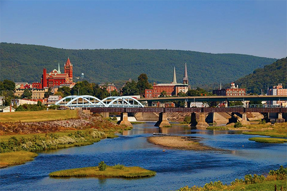
Cumberland, established as a town in 1787, was once the second largest city in Maryland. During the Industrial Revolution the mountains of the Cumberland region provided coal, iron ore and timber, which turned the city into a key manufacturing center. Other industries took off as well, like glass, breweries, fabrics, and tinplates. Prior to the arrival of the railroad and the canal, the National Road brought travelers to Cumberland. The railroad made it to Cumberland in 1842, followed by the canal in 1850. At that time, use of the National Road began to decline. The last stagecoach line stopped operating in 1853. During much of the Civil War, Union General Benjamin Kelley’s troops, headquartered in Cumberland, were responsible for protecting the B&O Railroad and the canal. Following World War II, industry in Cumberland began to decline, as did the population. Today, Cumberland is a member of the Canal Towns Partnership and features a variety of shopping and history for tourists to discover.

Mile Marker 184.5             Canal Boat Replica

Visitors can tour “The Cumberland,” a full-sized replica canal boat constructed in 1976. Guides in period clothing interpret the history of the canal and daily life aboard a canal boat. Visitors can also tour the mule shed, hay house and furnished Captain’s cabin. Visit the Park’s website for more information and hours.

Share This Page

Canal Story #25: Justin Cole

By Canal Story

To celebrate the 50th anniversary of the C&O Canal becoming a National Historical Park, we are featuring 50 Canal Stories throughout 2021. Each story will take a look at a person’s relationship with the C&O Canal. Whether an NPS ranger, a volunteer, or a visitor, everyone has a story to tell about the canal! If you want to share your story, submit it to us at the link here, email it to us at [email protected] or post it on your social media feeds with the hashtag #MyCanalStory.

Tell Us Your Canal Story

Justin Cole, TowpathGO! Fundraiser

C&O Canal Trust: What is your history / relationship with the C&O Canal?
Justin:
Like many people, my relationship with the Canal has been mostly focused around its recreational use; although I volunteered for a time at the National Park Service’s Adventure Station at the REI in DC, where I got a chance to learn much more about its incredible history and talk to people about the region’s plentiful parks and trails.

C&O Canal Trust: When did you first learn of the C&O Canal?
Justin: I first learned of it when I moved to the DC area in 2011. At the time, I was living in Arlington and training for marathons by going on long runs on the W&OD trail. While I love that trail, I was looking for variety and learned about our broader network of incredible trails in the DC area, including the Anacostia River Trail, Capital Crescent, Mt. Vernon, and Metropolitan Branch Trail. While each trail is unique in its own way, the Canal’s wildlife, views, and surface make it my favorite in the DC region.

C&O Canal Trust: Tell us about your lockhouse stay to celebrate your 30th birthday.
Justin: I’ve always enjoyed trail running, history, and camping, so my girlfriend knew that staying in a lockhouse would be a special way to spend my 30th birthday. Not only did she book Lockhouse 49 for a weekend, but she surprised me by inviting my best friends to join us, who traveled from as far away as Montana and Michigan to celebrate my birthday, resulting in a weekend that I’ll never forget.

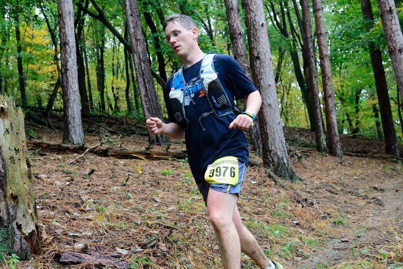
C&O Canal Trust: Why did you sign up for TowpathGO!?Justin: I’ve benefited so much from the C&O Canal, so I thought this would be a great way to honor the work of the many people who have made it possible for me (and millions of others!) to enjoy it each year. As for the distance I chose (50 miles), that was influenced in part by a challenge that my two favorite presidents, Teddy Roosevelt and John F. Kennedy, each proclaimed 60 years apart, challenging the military to march 50 miles in order to remain in good order. In fact, after JFK issued his challenge in 1962 there were numerous ‘JFK 50 mile’ ultramarathons that existed across the country. I’ve run a 50K before, but never this distance, so I thought this was a perfect opportunity to do so.

C&O Canal Trust: Do you have a favorite memory of the Park?
Justin: My favorite memory has got to be going for a run with my friends on my 30th birthday weekend and then cooling off by going whitewater rafting in Harpers Ferry.

Canal Story #24: John Kehne

By Canal Story

To celebrate the 50th anniversary of the C&O Canal becoming a National Historical Park, we are featuring 50 Canal Stories throughout 2021. Each story will take a look at a person’s relationship with the C&O Canal. Whether an NPS ranger, a volunteer, or a visitor, everyone has a story to tell about the canal! If you want to share your story, submit it to us at the link here, email it to us at [email protected] or post it on your social media feeds with the hashtag #MyCanalStory.

Tell Us Your Canal Story

John Kehne, Canal Steward & TowpathGO! Fundraiser

C&O Canal Trust: What is your relationship with the C&O Canal? 
John: I grew up about 7 miles from Williamsport MD, the canal town that is the current headquarters of the C&O Canal Trust. Over 50 years ago, I and a group of fellow Maryland scouts biked in segments the entire length of the towpath, a tremendous adventure that opened our eyes to the beauty and history of the canal and provided us with a multitude of experiences that enriched our lives. After high school, I left the state to pursue training and a career in Neuroscience and forty years later, returned to Maryland. My wife and I fortuitously live close to the canal, 7 miles from the Great Falls Tavern Visitor Center. For the last decade, the Park has been a welcome refuge for hiking, biking, running, and a place to enjoy nature in all seasons. Recently, I began volunteering at the Park through a C&O Canal Trust-managed “Canal Stewards” program and am further committed to give back to the Park seeking donations to my TowpathGO! fundraiser, challenging myself to complete a one day 50-mile ride on the towpath.

C&O Canal Trust: When did you first learn of the C&O Canal?
John: Fishing trips to the Potomac River during my youth made me aware of the canal, but I didn’t really fully experience it until my bicycle trip. 

C&O Canal Trust: Tell us about your Maryland scouts biking trip.
John: We had done a lot of camping but not major biking, so this was a new, exciting adventure that was also humbling. The trip was done in five segments, completed over a summer. Riding a Schwinn 2-speed “kick-back” bicycle, I soaked up the scenery and gained an appreciation for the park’s size and the quiet remoteness of many stretches. The trips did not lack drama and taught us some lessons. “Expect the unexpected”. We expected rain and mud, but not a washed-out section of the towpath or encounters with four-foot high, bike-stopping grass.  More often than not, planned early evening arrivals at our destinations occurred in early morning. “It ain’t over ‘til it’s over”. I voluntarily gave up my bike and pushed, for the last 5 miles of the final segment, a fellow scout’s bike that had catastrophically broken down. I ran to keep from falling behind the others, and suffice it to say that the mile markers were slow in coming and the last mile seemed like ten. I “dug deep” and finished exhausted but happy to have helped out.  Twenty five years later, I found myself again digging deep to finish the final five miles of my first marathon (Chicago) and in a time that qualified me to run in the 1996 Boston Marathon, its’ 100th anniversary.  Two dreams of mine achieved!  The canal experience can be impactful.

C&O Canal Trust: What is your favorite thing about being a canal steward? 
John: It’s a “win-win” – I get exercise in a rich outdoor setting and make contributions that enhance the park’s towpath and trails. A bonus is my occasional interactions with the Trust and Park staff, other volunteers and enthusiastic park visitors.

C&O Canal Trust: Why did you sign up for TowpathGO!? 
John: The C&O Canal Historical Park is a monument to an important period of American history and an amazing natural resource, a great example of why the National Parks are truly “America’s Greatest Idea”. I was motivated to sign up as another way to give back to the park and knowing that donations to the Trust in TowpathGO! will benefit important and innovative programs, including the Trust’s “Towpath Forever” and “Canal Classrooms” initiatives. Regarding my personal challenge to bike 50 miles on the towpath in one day, it seemed appropriate since it has been a half-century since the canal became a park and since I biked the entire towpath.

C&O Canal Trust: Do you have a favorite memory of the Park? 
John: When training for the 2013 and 2015 Marine Corps Marathons, I did my “long-runs” on the towpath, doing loops starting at Great Falls Tavern Visitor Center and heading downstream toward Georgetown.  On one memorable early morning run, not a person in sight, I was captivated by the canal as a blue heron flew gracefully by, the rays from the rising sun illuminating the mist above the shimmering water. What a way to train!

C&O Canal Trust: What is your favorite place or section of the Park?  
John: The section of the Park that extends a mile downstream (to MM13) and upstream (to MM15) from the Great Falls Tavern Visitor Center. In addition to the highly popular Great Falls Overlook, Widewater section, Rocky Island views, and challenging Billy Goat Trail A, these two amazing miles contain a selection of many trails, some lesser known or used. The mile long River Trail takes you down to river level with great river views and bird watching, and the rich soil supports gigantic sycamore trees, and, in the spring, spectacular wildflower shows. On the other side of the canal, the Ford Mine Trail is a 3 mile loop that winds through stands of tall trees, ascending and descending knolls to cross small streams. This being said, I still have much exploring to do.

Canal Story #23: Katie Rapp

By Canal Story

To celebrate the 50th anniversary of the C&O Canal becoming a National Historical Park, we are featuring 50 Canal Stories throughout 2021. Each story will take a look at a person’s relationship with the C&O Canal. Whether an NPS ranger, a volunteer, or a visitor, everyone has a story to tell about the canal! If you want to share your story, submit it to us at the link here, email it to us at [email protected] or post it on your social media feeds with the hashtag #MyCanalStory.

Tell Us Your Canal Story

Katie Rapp, TowpathGO! Fundraiser, Bike Rider, & C&O Canal Photographer

I owe my sanity over the past year to my frequent bike rides along the C&O Canal. The beauty, wildlife, solitude, fresh air, and nightly light show over the Potomac keep me coming back. I’m raising funds for the C&O Canal Trust so they can continue to maintain this 184.5 mile treasure that runs from Georgetown to Cumberland. Because TowpathGO! is in honor of the 50th anniversary of the canal becoming a park, my initial goal was to ride 50 miles and raise $1,000 (matching up to $500). I met those goals in a couple days, so switched to 100 miles and $1,500. I’m past 100 miles already, so I’ve upped the ante again and am now planning to ride 184.5 miles (the length of the canal) and raise $1,845 for the Canal Trust by July 10. I’m probably going to pass my mileage goal this coming week, so I’ll just keep riding! Please help me pass my fundraising goal, too! https://secure.givelively.org//donate/c-o-canal-trust-inc/towpathgo-2021/katie-rapp-2

Follow me on Facebook to see lots of photos and updates from my bike rides: https://www.facebook.com/katie.rapp1

C&O Canal Trust: What is your relationship with the C&O Canal?
Katie: I love riding my bike on the towpath. I also love learning about the history. I’ve taken many guided hikes in the Park over the years – Seneca Quarry where the stone used to build the Smithsonian Castle came from, Blockhouse Point with its wildflowers and Civil War history, Monocacy Aqueduct, birding walks (heron nurseries! eagles’ nests!). I’ve been hanging around the canal for a long time!

C&O Canal Trust: When did you first learn of the C&O Canal?
Katie: When I lived in DC many years ago, I visited Great Falls a few times and saw the canal, but I didn’t know about the towpath running from Georgetown to Cumberland until I moved to Gaithersburg in 1999. I don’t like riding my bike on roads around here and the terrain is a bit hilly for me, so the towpath is perfect.

I’ve been busy raising my kids (now teens) and so my bike rides were few and far between due to kids’ activities and general busy-ness. Then came COVID and full stop on all the lessons and practices. My very first thought with nowhere else to go was I need to get out on the towpath. I didn’t have a bike rack, so I shoved my bike into the back of my car! Weather permitting, I’ve been riding almost nightly after work since last March.

C&O Canal Trust: What is your favorite place to photograph in the Park?
Katie: I am addicted to sunsets over the Potomac. There are a bunch of spots where I love the sunsets at different times of the year. Violette’s Lock sunsets in winter and early spring are amazing. There’s a spot about a mile below Violette’s Lock that has an amazing view up the Potomac and the river glows pink and purple. It’s really gorgeous. There are also bends in the towpath where the sun shoots through trees and just lights the sky on fire, reflecting in the canal. I love all these spots and many more.

I’m not really a photographer, at all, even though I enter the Trust’s photo contest a lot and had some photos in the Washington County Arts Council competition! A couple years ago I told my friend how beautiful it was on my bike rides, and she asked me to send her photos. I started taking quick snapshots on my cellphone and texting them to her during my rides. It’s so beautiful on the towpath, it would be impossible to take bad pictures! But my photos are all just quick snapshots on my cell as I’m riding my bike. I miss more shots than I get, and it’s always way more beautiful in person than whatever I capture in my photos. 

During COVID I looked back at my cell phone photos and realized I’d taken some nice pictures. I started sharing them on Facebook just to cheer people up and as a nice distraction this past year. I attach my photos to emails at work, as well. Just something cheerful in a hard year. People like them. 

C&O Canal Trust: Why did you sign up for TowpathGO!?
Katie: Tymber at the Canal Trust suggested it to me. I’m happy to help! I never kept track of how far I was riding, so this has been fun to see how fast the miles are adding up. I’m updating my Facebook with photos after each ride. I also post about wildlife I see and any highlights each night. I mention some history and (of course!) the amazing work of the Canal Trust – resurfacing the towpath, Canal Quarters, etc. I’m so happy to support the Trust.

C&O Canal Trust: Do you have a favorite memory of the Park?
Katie: I’m not exaggerating to say the Park helped me get through this whole year. I will always remember this and be thankful that I had this beautiful place to go. Along with the pandemic and all the things in the news, my dad passed away last summer and I had other stresses. Every night, as I drove out of my neighborhood toward the Park, I felt all the stress melt away. I can’t even explain how much this has meant to me!

C&O Canal Trust: What is your favorite place or section of the Park?
Katie: I love the section below Blockhouse Point where the towpath is suspended between the canal and the Potomac with the beautiful stone bluff above the canal. It’s so dramatic and peaceful. There’s often no one else around and I just stop and enjoy it. One time last summer a beaver mom and her baby came up out of the river right next to me! Another spot I love is at Nolands Ferry. Someone cuts stairs into the dirt on the river bank and there’s a secluded little pebble beach on the Potomac. It’s gorgeous.

Canal Story #22: Lois Turco

By Canal Story

To celebrate the 50th anniversary of the C&O Canal becoming a National Historical Park, we are featuring 50 Canal Stories throughout 2021. Each story will take a look at a person’s relationship with the C&O Canal. Whether an NPS ranger, a volunteer, or a visitor, everyone has a story to tell about the canal! If you want to share your story, submit it to us at the link here, email it to us at [email protected] or post it on your social media feeds with the hashtag #MyCanalStory.

Tell Us Your Canal Story

Lois Turco, long-time volunteer with Canal Towns Partnership

Growing up in Washington, D.C., along River Road, my parents and I often took a drive down to Falls Road into McArthur Blvd. and parked across from Old Anglers Inn and walk the towpath to Widewater. Back then, the large basin was undergoing some repair. Walking along the washed-out towpath was tricky. I remember seeing many fishermen and canoes. Access to the Falls was through a toll gate, and the hardy walkers held onto the somewhat unstable rails to see the Great Falls. The park was in my backyard and D.C. and MD residents took advantage of its proximity.
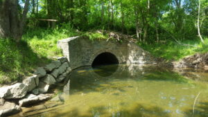
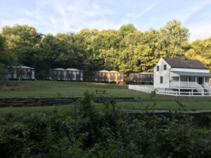
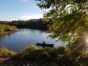
Returning to the United States after five tours abroad, we rediscovered the canal as a National Historical Park within the NPS. From where we lived in Rockville, MD, near Falls Road, it was an easy drive to the park. Again the park, the towpath, and its proximity to the river provided needed respite and renewal.

After retirement, we moved to Shepherdstown, WV, and quickly discovered that the park was again in our backyard. I became a Shepherdstown Rotarian and worked with the C&O Canal National Historical Park to design a ramp which would make accessibility from the Lock 38 towpath up to the new Rumsey Bridge a reality. From there, I worked with the NPS River, Trails, Conservation Assistance (RTCA) to facilitate the creation of a new program within the C&O Canal Trust: the Canal Towns Partnership, which promotes the sustainable economic development of our Canal Towns by promoting recreational tourism and the experience of the town and the park in partnership. Since 2011, I have been a board member and for four years chair of the Partnership. I enjoy being a Shepherdstown trail ambassador. Indeed, the canal, whether then or now, remains a fixture in my life.

Adopt A Site!

By Volunteer

‘Culvert Near Pennyfield Lock’ by Jim Blair

Montgomery County

1.07 Alexandria Aqueduct
Location: Aqueduct Bridge, Washington, DC 20007 Mile 1.07
About: Built between 1833 and 1843, the Alexandria Aqueduct Bridge stood as a technological marvel of early 19th century engineering. It was designed to connect the Chesapeake and Ohio Canal to the neighboring seaport at Alexandria via a seven-mile-long canal. 
Tasks:
-Pick up and remove trash
-Survey site for hazards and note condition of the site. 

5.03 Lock 5 area 
Location: Mile Marker 5
Lock 5, Bethesda, MD 20816 
About: The stone is original and came from Aquia creeks and a nearby quarry.
Tasks:  
-Pick up and remove trash from site.
-Paint park features such as signs and picnic tables.
-Survey site for hazards and note condition of the site. 
-Clean signs.

5.5 Lock 6 area
Location: 6100 Clara Barton Parkway Bethesda, MD 20816 Mile 5.4
Tasks: 
-Pick up and remove trash from site.
-Paint park features such as signs and picnic tables.
-Survey site for hazards and note condition of the site. 
-Clean signs.

7.04 Lock 7 area
Location: 38.9642839, -77.1381624 Mile Marker 7
Tasks:
-Pick up and remove trash from site.
-Paint park features such as signs and picnic tables.
-Survey site for hazards and note condition of the site. 
-Clean signs.

8.3 Lock 8 area
Location: 38.9715934, -77.160773 Mile: 8.3
Tasks:
-Pick up and remove trash from site.
-Paint park features such as signs and picnic tables.
-Survey site for hazards and note condition of the site. 
-Clean signs.

10.5 Carderock Day Use Area
Location:
North parking lot 38.9761688, -77.2053287 Mile: 10.9
South parking lot 38.9725971, -77.2004106 Mile: 10.4
About: Picnic and recreation area
Tasks:
-Pick up and remove trash from site.
-Paint park features such as signs and picnic tables.
-Remove ash from fire ring.
-Survey site for hazards and note condition of the site. 
-Clean signs.
-Remove trash from boat ramp

14 Great Falls sites
Location: 11710 MacArthur Blvd., Potomac, MD Mile: 14
About: 
While many trails, overlooks, locks, Canal boat rides, and the Washington Aqueduct provide plenty to see and do at Great Falls, the centerpiece is the Great Falls Tavern. Originally a lockkeeper’s house built in 1829, it was enlarged and transformed into a popular hotel called the Crommelin House. The hotel was a favorite of Congressmen and other high officials in Washington. Not so much for the canal boat community, who complained the tourists interfered with their journey through the locks.
14 Great Falls Fee booth Mile 14
Tasks:
-Pick up and remove trash from site.
-Paint park features such as signs and picnic tables.
-Survey site for hazards and note condition of the site. 
-Clean signs.

14 Great Falls Entrance Road Mile 14
Tasks:
-Pick up and remove trash from site.
-Paint park features such as signs and picnic tables.
-Survey site for hazards and note condition of the site. 
-Clean signs.

Lander Road Lockhouse by Katherine Zitrick

 Frederick and Montgomery County

26.1 Horsepen Branch Hiker-Biker Campsite
Location:  Chesapeake and Ohio Canal Towpath Poolesville, MD 20837 Mile marker 26.1
About: The Horse Pen Branch campsite is a hiker/biker campsite not accessible by car.
Tasks:
-Pick up and remove trash from site.
-Paint park features such as signs and picnic tables.
-Remove ash from fire ring.
-Survey site for hazards and note condition of the site. 
-Clean signs.

30.5 Chisel Branch Hiker-Biker campsite
Location: Poolesville, MD 20837 Mile  30.5
About: The Chisel Branch Campsite is a hiker-biker campsite named after for a stream that crosses beneath the canal approximately half a mile from the site
Tasks:
-Pick up and remove trash from site.
-Paint park features such as signs and picnic tables.
-Remove ash from fire ring.
-Survey site for hazards and note condition of the site. 
-Clean signs.

34.4 Turtle Run Hiker-Biker Campsite
Location: Turtle Run Campsite, Chesapeake and Ohio Canal Towpath, Dickerson, MD 20842 Mile 34.4
About: One of the regularly spaced hiker/biker campsites along the towpath, Turtle Run provides a front row seat to Civil War history—in the middle of the Potomac. Turtle Run offers views of Harrison Island from your tent flaps. 
Tasks:
-Pick up and remove trash from site.
-Paint park features such as signs and picnic tables.
-Remove ash from fire ring.
-Survey site for hazards and note condition of the site. 
-Clean signs.

47.65 Calico Rock Hiker Biker Campsite
Location: Point of Rocks, MD 21777 Mile 47.6
About: Calico Rocks is a hiker-biker campsite. It is named after a type of composite stone found in this area. Sometime known as “Potomac Marble,” Calico Rocks was a jumble of pebbles mixed into limestone.
Tasks: 
-Pick up and remove trash from site.
-Paint park features such as signs and picnic tables.
-Remove ash from fire ring.
-Survey site for hazards and note condition of the site. 
-Clean signs.

50.3 Bald Eagle Island Hiker Biker Campsite
Location: Jefferson, MD 21755 Mile 50.3 
About: The Bald Eagle Island campsite is located just north of the narrow Point of Rocks section of the Potomac, a historic point of contention between the Canal and the B&O Railroad for right of way.
Tasks:
-Pick up and remove trash from site.
-Paint park features such as signs and picnic tables.
-Remove ash from fire ring.
-Survey site for hazards and note condition of the site. 
-Clean signs.

61.57 Lock 34 Area
Location: Knoxville, MD 21758 Mile 61.57
About: One of 74 locks located throughout the C&O Canal National Historical Park. Locks were used to raise and lower boats. 
Tasks:
-Pick up and remove trash from site.
-Paint park features such as signs and picnic tables.
-Remove ash from fire ring.
-Survey site for hazards and note condition of the site. 
-Clean signs.

62.09 Huckleberry Hill Hiker-Biker campsite
Location: Knoxville, MD 21758 Mile62.09
About: This hiker-biker campsite is located near where the Canal landing for the Potomac Refining Company’s landing once stood. 
Tasks: 
-Pick up and remove trash from site.
-Paint park features such as signs and picnic tables.
-Remove ash from fire ring.
-Survey site for hazards and note condition of the site. 
-Clean signs.

64.9 Dargan Bend Boat Ramp
Location:  Sharpsburg, MD 21782 Mile 64.9
About: Access for small boats on the Potomac River. Located upstream of Harpers Ferry.
Tasks:
-Pick up and remove trash from site.
-Paint park features such as signs and picnic tables.
-Remove ash from fire ring.
-Survey site for hazards and note condition of the site. 
-Clean signs.
-Remove trash from boat ramp

Paddling at Antietam Creek by Nora Slick

Washington County

69.4 Antietam Aqueduct
Location: Sharpsburg, MD 21782 Mile 69.4
About: Carrying the C&O Canal over the Antietam is the Antietam Aqueduct, a three-span, 140-foot bridge that was completed in 1834. It was the fourth of 11 aqueducts built along the Canal. Heavily damaged during the Civil War, the aqueduct has been rebuilt and has otherwise withstood the forces of time and nature very well.
Tasks:
-Pick up and remove trash from site.
-Paint park features such as signs and picnic tables.
-Survey site for hazards and note condition of the site. 
-Clean signs.

69.6 Antietam Campground GROUP SITE
Location: Sharpsburg, MD 21782. Mile 69.6
About: Just upstream about a quarter-mile from the mouth of Antietam Creek you’ll find the Antietam Drive-in Campground.
Tasks:
-Pick up and remove trash from site.
-Paint park features such as signs and picnic tables.
-Remove ash from fire ring.
-Survey site for hazards and note condition of the site. 
-Clean signs.

75.4 Killiansburg Cave Hiker-Biker Campsite
Location: Sharpsburg, MD 21782 Mile 75.4
About: This is a hiker-biker campsite. 
Tasks:
-Pick up and remove trash from site.
-Paint park features such as signs and picnic tables.
-Remove ash from fire ring.
-Survey site for hazards and note condition of the site. 
-Clean signs.

76.67 Snyders Landing
Location: Snyders Landing, Sharpsburg, MD 21782
About: Another point of boat access to the Potomac River, Snyders Landing also includes parking on the berm side of the Canal. Originally named for the nearby town of Sharpsburg, it was later re-named after a local coal and grain establishment near the Canal here.
Tasks:
 -Pick up and remove trash from site.
-Paint park features such as signs and picnic tables.
-Survey site for hazards and note condition of the site. 
-Clean signs.
-Remove trash from boat ramp

79.07 Horseshoe Bend Hiker-Biker Campsite
Location: Sharpsburg, MD 21782 Mile 79.07
About: Where the Potomac River makes a huge U-shaped turn is the appropriately named Horseshoe Bend Campsite. Like other hiker/biker overnight stops
Tasks: 
-Pick up and remove trash from site.
-Paint park features such as signs and picnic tables.
-Remove ash from fire ring.
-Survey site for hazards and note condition of the site. 
-Clean signs.

80.9 Taylors Landing Boat Ramp
Location:  Sharpsburg, MD 21782
About: Taylors Landing Boat Ramp has access to towpath as well. 
Tasks:
 -Pick up and remove trash from site.
-Paint park features such as signs and picnic tables.
-Remove ash from fire ring.
-Survey site for hazards and note condition of the site. 
-Clean signs.
-Remove trash from boat ramp.

82.07 Big Woods Hiker-Biker Campsite  
Location:
About: This hiker-biker campsite is not visible from the towpath. Bear Cave is half a mile upstream from this campsite. 
Tasks: 
-Pick up and remove trash from site.
-Paint park features such as signs and picnic tables.
-Remove ash from fire ring.
-Survey site for hazards and note condition of the site. 
-Clean signs.

85.02 Dam 4 Area
Location: Dam 4 Rd, Maryland 21782 Mile 85
About: The seven dams on the Potomac River were originally built to divert water into the canal. Dam #4 provided water for 22 miles of the canal, from Milepost 84.6 downstream to Milepost 62.3, just above Harpers Ferry. The water was regulated at the guard lock at Dam #4 to maintain a consistent level of water traveling at two miles per hour down the canal prism.
Tasks:
-Pick up and remove trash from site.
-Paint park features such as signs and picnic tables.
-Survey site for hazards and note condition of the site. 
-Clean signs.

90.9 Opequon Junction Hiker-Biker campsite
Location: 
About: Looking across the Potomac from this campground, you’ll see the mouth of its namesake creek. Historically, Opequon Creek played an important role in pre-1800 America.
Tasks:
-Pick up and remove trash from site.
-Paint park features such as signs and picnic tables.
-Remove ash from fire ring.
-Survey site for hazards and note condition of the site. 
-Clean signs.

95.2 Cumberland Valley Hiker-Biker campsite
Location: Williamsport, MD 21795 Mile 95.2
About: The first campsite south of Williamsport on the Canal, Cumberland Valley Campsite is named after the nearby railroad of the same name. The Cumberland Valley Railroad was built to connect Harrisburg, PA with Chambersburg—another Pennsylvania town near the Maryland border
Tasks:
 -Pick up and remove trash from site.
-Paint park features such as signs and picnic tables.
-Remove ash from fire ring.
-Survey site for hazards and note condition of the site. 
-Clean signs.

101.3 Jordan Junction Hiker-Biker Campsite
Location: Williamsport, MD 21795 Mile 101.3
About: This is the closest campsite to Williamsport. 
Tasks: 
-Pick up and remove trash from site.
-Paint park features such as signs and picnic tables.
-Remove ash from fire ring.
-Survey site for hazards and note condition of the site. 
-Clean signs.

Four Locks Reflections by Caleb Hayes

Four Locks-Washington County

109.6 North Mountain Hiker-Biker campsite
Location: Clear Spring, MD 21722 Mile 109.6
About: The name of this campsite comes from the high ridge across the Potomac River. Many people here also know it as Fairview Mountain. 
Tasks:
-Pick up and remove trash from site.
-Paint park features such as signs and picnic tables.
-Remove ash from fire ring.
-Survey site for hazards and note condition of the site. 
-Clean signs.

110.02 McCoys Ferry Campground GROUP SITE
Location:
About: This is a drive-in campground.
Tasks:
Pick up and remove trash from site.
-Paint park features such as signs and picnic tables.
-Remove ash from fire ring.
-Survey site for hazards and note condition of the site. 
-Clean signs.

Washington county

110.02 McCoys Ferry Day Use/Boat Ramp Area
Location: Clear Spring, MD 21722 Mile 110.02
About: Fords and ferries were once located all along the 184.5 miles of the C&O Canal, providing places to cross the Potomac River. McCoys Ferry was one of those crossing sites.
Tasks:
 -Pick up and remove trash from site.
-Paint park features such as signs and picnic tables.
-Remove ash from fire ring.
-Survey site for hazards and note condition of the site. 
-Clean signs.
-Remove trash from boat ramp

116.04 Licking Creek Hiker-Biker Campsite
Location: Big Pool, MD 21711 Mile 116.04
About: This is a Hiker-Biker campsite near Licking Creek Aqueduct. Built between 1836 and 1838, the Licking Creek aqueduct is the first of six single-arch aqueducts on the line of the canal and the longest of the Canal’s aqueducts.
Tasks: 
-Pick up and remove trash from site.
-Paint park features such as signs and picnic tables.
-Remove ash from fire ring.
-Survey site for hazards and note condition of the site. 
-Clean signs.

120.39 Little Pool Hiker-Biker Campsite
Location: Hancock, MD 21750 120.39
About: Little Pool Campground provides great access to a number of Canal landmarks. To the south is Fort FrederickBig Pool and Licking Creek Aqueduct
Tasks:
-Pick up and remove trash from site.
-Paint park features such as signs and picnic tables.
-Remove ash from fire ring.
-Survey site for hazards and note condition of the site. 
-Clean signs.

124.33 Little Tonoloway Day Use Area
Location: Hancock, MD 21750 Mile 124.33
About: Situated between the canal and Potomac River, this recreation area features picnic tables and a boat launch.
Tasks: 
-Pick up and remove trash from site.
-Paint park features such as signs and picnic tables.
-Survey site for hazards and note condition of the site. 
-Clean signs.

124.33 Little Tonoloway Boat Ramp
Location: Hancock, MD 21750 Mile 124.33
About: 
Tasks:
-Pick up and remove trash from site.
-Paint park features such as signs and picnic tables.
-Survey site for hazards and note condition of the site. 
-Clean signs.
-Remove trash from boat ramp

126.5 White Rock Campsite
Location: Hancock, MD 21750 Mile 126.5
Tasks:
-Pick up and remove trash from site.
-Paint park features such as signs and picnic tables.
-Remove ash from fire ring.
-Survey site for hazards and note condition of the site. 
-Clean signs.

129.8 Leopards Mill Hiker-Biker
Location: Hancock, MD 21750 Mile 129.8
About: This riverside campsite was named after Jacob Leopard who operated a gristmill about a mile upstream.
Tasks:
-Pick up and remove trash from site.
-Paint park features such as signs and picnic tables.
-Remove ash from fire ring.
-Survey site for hazards and note condition of the site. 
-Clean signs.

133.6 Cacapon Junction Hiker-Biker
Location: Hancock, MD 21750 Mile 133.6
Tasks:
-Pick up and remove trash from site.
-Paint park features such as signs and picnic tables.
-Remove ash from fire ring.
-Survey site for hazards and note condition of the site. 
-Clean signs.

Paw Paw tunnel: North Portal by Paul Graunke

Allegany

139.02 Indigo Neck Hiker-Biker Campsite
Location:  Little Orleans, MD 21766 Mile 139.02
About: Just a mile and a half downstream of the small town of Little Orleans, Indigo Neck campground is located on the southeastern tip of the expansive Green Ridge State Forest, with opportunities for hiking, off-road vehicles, fishing, boating and horseback riding.
Tasks:
-Pick up and remove trash from site.
-Paint park features such as signs and picnic tables.
-Remove ash from fire ring.
-Survey site for hazards and note condition of the site. 
-Clean signs.

140.15 Fifteen Mile Creek Boat Ramp
Location: Little Orleans, MD 21766 Mile 140.15
Tasks:
-Pick up and remove trash from site.
-Paint park features such as signs and picnic tables.
-Remove ash from fire ring.
-Survey site for hazards and note condition of the site. 
-Clean signs.
-Remove trash from boat ramp

140.15 Fifteen Mile Creek Campground/Aqueduct
Location: Little Orleans, MD 21766 Mile 140.15
About: Accessible by road. Just downstream from the mouth of Fifteen mile Creek is the town of Little Orleans, which served as a point of lumber transshipment on the Canal
Tasks:
-Pick up and remove trash from site.
-Paint park features such as signs and picnic tables.
-Remove ash from fire ring.
-Survey site for hazards and note condition of the site. 
-Clean signs.

149.4 Stickpile Hill Hiker-Biker Campsite
Location: Big Pool, MD 21711 Mile 149.4
About: Stickpile Hill is another ridge that forces the Potomac River in its looping pattern along the southern edge of Green Ridge Forest State Forest
Tasks:
-Pick up and remove trash from site.
-Paint park features such as signs and picnic tables.
-Remove ash from fire ring.
-Survey site for hazards and note condition of the site. 
-Clean signs.

154.1 Sorrel Ridge Hiker-Biker Campsite
Location: Big Pool, MD 21711 Mile 154.1
Tasks:
-Pick up and remove trash from site.
-Paint park features such as signs and picnic tables.
-Remove ash from fire ring.
-Survey site for hazards and note condition of the site. 
-Clean signs.

157.4 Purslane Run Hiker-Biker Campsite
Location: Oldtown, MD 21555 Mile 157.4
About: The Purslane Run Campsite is a half mile upstream from where the Western Maryland Railroad crosses back over the Potomac into Maryland. It is named for a stream another half mile up the Canal.
Tasks:
-Pick up and remove trash from site.
-Paint park features such as signs and picnic tables.
-Remove ash from fire ring.
-Survey site for hazards and note condition of the site. 
-Clean signs.

162.1 Town Creek Aqueduct
Location: Oldtown, MD 21555 Mile 162.1
About: Town Creek Aqueduct is a single-span aqueduct. It is the tenth of eleven aqueducts on the Canal and, like many of the other eleven, is missing its upstream wall.
Tasks:
-Pick up and remove trash from site.
-Paint park features such as signs and picnic tables.
-Remove ash from fire ring.
-Survey site for hazards and note condition of the site. 
-Clean signs.

164.8 Potomac Forks Campsite
Location: Oldtown, MD 21555 Mile 164.5
Tasks: 
-Pick up and remove trash from site.
-Paint park features such as signs and picnic tables.
-Remove ash from fire ring.
-Survey site for hazards and note condition of the site. 
-Clean signs.

169.17 Pigmans Ferry Campsite
Location: Oldtown, MD 21555 Mile 169.17
About: The name of this campsite is somewhat misleading. The site of the actual ferry is more than a mile and a half upstream and the campsite itself is not on the river—rather it is along the part of the Canal that veers inland away from the Potomac. The fenced off camping area borders a meadow.
Tasks:
-Pick up and remove trash from site.
-Paint park features such as signs and picnic tables.
-Remove ash from fire ring.
-Survey site for hazards and note condition of the site. 
-Clean signs.

173.03 Spring Gap Campground
Location: Oldtown, MD 21555 Mile 173
Tasks:
-Pick up and remove trash from site.
-Paint park features such as signs and picnic tables.
-Remove ash from fire ring.
-Survey site for hazards and note condition of the site. 
-Clean signs

175.4 Irons Mountain Hiker-Biker Campsite
Location: Cumberland, MD 21502 Mile 175.4
About: The Irons Mountain Ridge is the Canal’s last formidable ridge to navigate as it makes its way toward Cumberland. The campsite is upstream about a mile from the Narrows, the point where the River and the Canal squeeze by the ridge.
Tasks:
-Pick up and remove trash from site.
-Paint park features such as signs and picnic tables.
-Remove ash from fire ring.
-Survey site for hazards and note condition of the site. 
-Clean signs

184 Cumberland Terminus
Location: Cumberland, MD 21501 Mile 184
About: Cumberland may be the end of the C&O Canal, but it was also once known as the “Gateway to the West.” The Potomac River cuts through the mountains in and around Cumberland, providing one of the easiest westward crossings.
Tasks:
-Pick up and remove trash from site.
-Paint park features such as signs and picnic tables.
-Remove ash from fire ring.
-Survey site for hazards and note condition of the site. 
-Clean signs

Canal Story #21: Dan Spedden

By Canal Story

To celebrate the 50th anniversary of the C&O Canal becoming a National Historical Park, we are featuring 50 Canal Stories throughout 2021. Each story will take a look at a person’s relationship with the C&O Canal. Whether an NPS ranger, a volunteer, or a visitor, everyone has a story to tell about the canal! If you want to share your story, submit it to us at the link here, email it to us at [email protected] or post it on your social media feeds with the hashtag #MyCanalStory.

Tell Us Your Canal Story

Dan Spedden, President of Visit Hagerstown

C&O Canal Trust: What is your history with the C&O Canal?


Dan: I moved to Washington County permanently in 1986, when the Maryland Park Service promoted me to Park Manager for the South Mountain Recreation Area. Studying visitor patterns, I realized what trail connectivity meant for park visitors. The Maryland portion of the Appalachian National Scenic Trail ends at the C&O Canal. The South Mountain and Greenbrier State Park Trail systems are also accessible to the C&O Canal through the Appalachian Trail. After that, I began to study the history of the C&O Canal and discovered even more value in it. As President of Visit Hagerstown, Washington County’s destination marketing entity, I can say without a doubt the C&O Canal is our number one tourist attraction.

C&O Canal Trust: During your time working with the Trust, what is your favorite project you have been a part of?

Dan: Towpath resurfacing emerges as my favorite project. It is a high priority, and we are meeting it. C&O Canal users very much appreciate this effort.

C&O Canal Trust: Do you have a favorite canal memory?

Dan: The ribbon cutting for the aqueduct restoration in Williamsport is my favorite memory. The event was exciting, well attended, received wide media exposure, and was the satisfying culmination of years of work for a broad-based partnership.

C&O Canal Trust: What is your favorite spot on the canal?,

Dan: The Cushwa Basin is my favorite spot. The entire story of the canal can be told there.

C&O Canal Trust: What does the canal mean to you?

Dan: I promote and advocate for the Canal as part of my occupation, but it is so much more than that. When I retire in this community, I will use the towpath to remain healthy and active and be happy in the knowledge that it will always be there for me.

Canal Story #20: Hannah Debelius

By Canal Story

To celebrate the 50th anniversary of the C&O Canal becoming a National Historical Park, we are featuring 50 Canal Stories throughout 2021. Each story will take a look at a person’s relationship with the C&O Canal. Whether an NPS ranger, a volunteer, or a visitor, everyone has a story to tell about the canal! If you want to share your story, submit it to us at the link here, email it to us at [email protected] or post it on your social media feeds with the hashtag #MyCanalStory.

Tell Us Your Canal Story

Hannah Debelius, Canal Steward

C&O Canal Trust: What is your relationship with the C&O Canal?
Hannah: I grew up on the C&O Canal with frequent family walks from Violettes Lock and semi-annual canoe camping trips to the Paw Paw Tunnel. However, my family’s Canal legacy actually goes beyond that. My Grandparents owned a farm near Clear Spring, MD that is now part of the park. My Grandfather, Richard Costlow, was recognized by NPS in the 1970’s for the vast number of trees he planted, and he often told me how wonderful he thought the plans for the national park were when he saw them over 50 years ago.
C&O Canal Trust: When and how did you become involved with the C&O Canal Trust?
Hannah: In 2014, I saw a sign at Great Falls promoting Canal Community Day. I volunteered that year painting the mule shed and was hooked! Since then, I have also volunteered for Park After Dark, supported the Trust on Canal Giving Days, become a Canal Community Day project leader, and served as a Billy Goat Trail Steward with NPS since 2016.
C&O Canal Trust: What is / was your favorite part about being a volunteer?
Hannah: I love the community of volunteers I’ve met over the last few years. Everyone is so passionate about the Canal with their own stories and favorite spots. Having a scheduled excuse to be outside and enjoy the park is also a nice benefit.
C&O Canal Trust: What is / was your favorite part about being a project leader?
Hannah: At Canal Community Days, I love being able to work with different groups of volunteers, from school programs to hiking clubs and families. In the introduction, I always ask people what brought them out to volunteer today, and they have the best responses. Doing something tangible for the park I can see when I’m there, such as a freshly painted mule fence or filled pothole, also brings a sense of pride and connection.
C&O Canal Trust: Can you share a specific memory working a canal giving day?
Hannah: At Canal Giving Day, it always surprises me how many people want to walk up and give cash without any recognition or token in return. They are just out there enjoying the park and feel moved to give back.
C&O Canal Trust: Do you have a favorite memory of the Park?
Hannah: In 2019, my husband proposed to me on Billy Goat Trail section B. I was busy taking a photo of our dog at an overlook, and when I turned around, he was down on one knee. I cried a lot of tears of joy and am very thankful for a small group of hikers passing by that helped us capture the moment with a photo.
C&O Canal Trust: What is your favorite place or section of the Park?
Hannah: Although I spend most of my time at Great Falls and on the Billy Goat Trail, my favorite place is Lockhouse 49. It’s a special place where I’ve made a lot of memories with friends staying overnight with the Canal Quarters program, and the front porch with a morning cup of coffee can’t be beat.

Canal Story #19: Carol Moore

By Canal Story

To celebrate the 50th anniversary of the C&O Canal becoming a National Historical Park, we are featuring 50 Canal Stories throughout 2021. Each story will take a look at a person’s relationship with the C&O Canal. Whether an NPS ranger, a volunteer, or a visitor, everyone has a story to tell about the canal! If you want to share your story, submit it to us at the link here, email it to us at [email protected] or post it on your social media feeds with the hashtag #MyCanalStory.

Tell Us Your Canal Story

Carol Moore, Meditation and Yoga Instructor

C&O Canal Trust: What is your history/relationship with the canal? 
Carol: I was born and raised in the D.C. area and grew up hiking, biking, and generally enjoying the abundant beauty along the canal. When I planned to move to Phoenix, Arizona in my early 30s, my friend who lived there told me we could go running along a canal close to his house. I naturally pictured something akin to the C&O. Imagine my surprise when, instead of a peaceful, winding, water-laden landscape draped with gorgeous trees and filled with wildlife I encountered a canal made entirely of concrete. It extended straight as an arrow as far as the eye could see, surrounded by nothing but hot, dry, sandy dirt. I adjusted my expectations and had many happy runs on that “canal.” AND, in 2008 when my husband, our two sons and I moved to Potomac, Maryland, I fell in love with the C&O Canal as if I were seeing it for the first time. I can honestly say I’ve never taken it for granted since.

C&O Canal Trust: What is your favorite thing to do on the canal? 
Carol: I love to walk vigorously for exercise and pause frequently for marveling – mesmerized by an utterly motionless great blue heron on a gray-blue rock perch. Or delighted by an entire log jammed with turtles sunning themselves! 

C&O Canal Trust: Do you have a favorite spot on the canal? Why is it your favorite? 
Carol: I’m particularly partial to the stretch between Locks 22 and 23. I relish the soaring rock faces on one side and the spacious river views on the other.  

C&O Canal Trust: Can you share your favorite canal memory? 
Carol: This is a collage of memories — a guided imagery meditation I created about a hike near the Pennyfield Lock in August of 2020: https://mocomeditation.org/co-canal-stroll/

C&O Canal Trust: What does the C&O Canal mean to you? 
Carol: connection ~ calm ~ strength ~ nature ~ beauty ~ peace

Canal Story #18: Francis Grant-Suttie

By Canal Story

To celebrate the 50th anniversary of the C&O Canal becoming a National Historical Park, we are featuring 50 Canal Stories throughout 2021. Each story will take a look at a person’s relationship with the C&O Canal. Whether an NPS ranger, a volunteer, or a visitor, everyone has a story to tell about the canal! If you want to share your story, submit it to us at the link here, email it to us at [email protected] or post it on your social media feeds with the hashtag #MyCanalStory.

Tell Us Your Canal Story

Francis Grant-Suttie, Board Member of the C&O Canal Trust

C&O Canal Trust: What is your history with the C&O Canal?
Francis: Growing up in Zimbabwe, my earliest recollections were of hiking out in the wilderness with wildlife. Arriving in the United Sates in the mid-sixties, my family adopted the C&O Canal as our local ‘American wilderness’ in our own backyard. So I grew up exploring the billy goats trails, skating on the canal, canoeing from Swains lockhouse up the canal for picnics and long hikes with our dogs along the towpath. The C&O Canal  has an endless bounty of wild things and spaces for adventure.

C&O Canal Trust: During your time volunteering with the Trust, what is your favorite project you have been a part of?
Francis: I have thoroughly enjoyed being a quartermaster to Swains and Pennyfield lockhouses. Every time I set foot inside a lock house or cut the grass, or spruce the place up for spring cleanup, I am taken back to the 1830-50s and allow myself to re-imagine what life was like in the early days being a lock keeper or a canaller, the canal boats pulled by mules with all the attendant business of canal living with travel going up and down the towpath. To me, the lockhouses are representative of the entirety of the history of the canal to the present. It is always satisfying hearing our lockhouse guests regale how much fun they had staying over while feeling history seep through the stone walls, whispers of long ago beckoning to them in the middle of the night. One always remembers that night or weekend spent in a lockhouse.

C&O Canal Trust: Do you have a favorite canal memory?
Francis: Mike Mitchell, former chair of the Trust’s board and I decided to hike the towpath from Georgetown to Cumberland last September raising funds for the Trust as our Park After Dark annual fundraiser was canceled due to the covid pandemic. Both of us are photographers, so we took photographs documenting the beauty and grandeur of the canal, the towpath and river all the way north. 

The hike was a wonderful and exhilarating experience along an endless towpath. It was a walk through history: The American-Indian wars, The American Revolution and, especially The Civil War, in the steps of Union and Confederate armies slaughtering each other whether at Antietam or Gettysburg or any number of battles or skirmishes along the way. At times, I think the ghosts of warriors are coming out of the cornfields or the woods fixed bayonets charging straight our way. Or the skeletal hand, rearing up out from a forgotten graveyard trying to pull me back down into the netherworld of the slain. Canal hallucinations of a past reawakened!

But this was really about the present and future generations, who can enjoy the wonders of nature with ancient lockhouses guarding the canal and towpath, nestled by the Potomac River often built in wild and inhospitable places. One could only marvel at the engineering feat and sheer determination of those who built it. This was a continuous adventure with camera in hand, as there was something of interest around each corner: a run down grist mill, whiskey distillery, massive bluffs, the Paw Paw tunnel, caves where civil war refugees would seek safety, stunning vistas of the river with tall sycamores hovering over in their majesty, osprey, red-tailed and Cooper hawks, bald eagles, finches, warblers and eyes seemingly upon us constantly. One also experiences the astonishing refreshment of solitude.

But all hikes have a last step at an intended destination, and so Mike and I crossed that threshold and, of course, went to the closest pub for a celebratory beer! We toasted all our supporters of The Trust for what has become a memory of a lifetime. The photographic albums now tell the story. 

C&O Canal Trust: What is your favorite spot on the canal?
Francis: Just down from the Marsden bridge and campground, follow the path along the river up around some bends in the river there is a rock promontory jutting out into the Potomac. Our current family, the kids and dogs would hike to what we nicknamed “Lookout Rock” on a regular basis for picnic lunches. The dogs swim in a semi-enclosed pool and we sit on the rocks and spot eagles, songbirds, beaver, count turtles and all manner of wildlife. It is a place of bliss, togetherness and peace. To get there in the spring, one walks carefully amongst beds of Virginia bluebells wondering if you are floating on a sea of blue butterflies. Nature at its best. 

C&O Canal Trust: What does the canal mean to you?
Francis: The canal is a walking mediation where serenity, contemplation and awareness fill your every sense and being with energy, spirit and renewal. The canal is a never-ending story, a history of place and belonging where you just be. It gathers people into memories and stories that become family folklore.

A photo essay by Francis Grant-Suttie

“Moments in Time”

That fades to a fuzzy yet beautiful afterthought

Standing on the edge of a river, early morning mist, staring up at the endless towpath

Inspired

Passing by ancient dwellings, a lock house, a grist mill, memories of what was once a way of life


Mya, our future

Arriving at a destination, the last track

Only to turn around and go home

Francis

Canal Story #17: Margaret Clingan

By Canal Story

To celebrate the 50th anniversary of the C&O Canal becoming a National Historical Park, we are featuring 50 Canal Stories throughout 2021. Each story will take a look at a person’s relationship with the C&O Canal. Whether an NPS ranger, a volunteer, or a visitor, everyone has a story to tell about the canal! If you want to share your story, submit it to us at the link here, email it to us at [email protected] or post it on your social media feeds with the hashtag #MyCanalStory.

Tell Us Your Canal Story

Margaret J Clingan, Photographer

C&O Canal Trust: What is your relationship with the canal?
Maggie: The canal is where I go for restoration from life’s stresses and busyness. A trip to the canal always lifts my spirits and makes me smile. Nothing beats the sweet sound of birds singing and leaves swaying in the breeze during the warm seasons or the peaceful quietness that comes to the canal during the winter months.
C&O Canal Trust: Do you have a favorite memory of the park?
Maggie: My favorite memory of the park is when I first discovered the large patches of bluebells that bloom in early Spring. I was amazed at their beauty, and I couldn’t believe how much they filled the air with their perfume on a warm day. Ever since that discovery, I make a point to follow the progress of the bluebells each Spring and to be there when the magic happens.
C&O Canal Trust: What is your favorite place on the canal and why?
Maggie: The area surrounding mile markers 66 and 67. This is the area closest to where I live that I am able to enjoy the largest patches of bluebells and other Spring flowers such as the purple trillium. I know exactly where each trillium hides beneath the bluebells, and I return to the same spot each Spring to enjoy them. I’ve taken many photographs in this area and return every year. It is a very quiet and peaceful location along the canal with few visitors.
C&O Canal Trust: What does the canal mean to you?
Maggie:
Even though I don’t live right along the canal, it means home to me. The canal is a 5 minute drive from my house and a quick bike ride from my house also. Whenever my husband and I think about moving to a new home, the proximity to the canal is our number 1 consideration. I could not imagine living in any location where the canal is not close by.

C&O Canal Receives Funding from Great American Outdoors Act

By News
A project at Dam 5 along the C&O Canal  is one of 165 projects that will benefit from the recently-passed Great American Outdoors Act (GAOA). The GAOA is providing up to $1.9 billion a year for five years to the National Parks and Public Land Legacy Restoration Fund. This money will fund deferred maintenance projects in National Parks, forests, wildlife refuges, recreation  areas, and American Indian schools.   Read More

C&O Canal Sweet and Savory Trail

By Content

After your hike or bike ride along the C&O Canal, venture into the Canal Towns that line the towpath to enjoy a savory meal and sweet treat with our C&O Canal Sweet and Savory Trail! Thirsty? We also have a C&O Canal Libations Trail. These trails were developed in partnership with the Canal Towns Partnership.

MONTGOMERY COUNTY, MD

White’s Ferry Store and Grill

24801 Whites Ferry Rd., Dickerson, MD 20842
0.1 mile walk/ride from the C&O Canal

Savory: White’s Ferry Burger: Burger with bacon, lettuce, tomatoes, and a fried egg, with the addition of onion rings.
Release Date: Available now

FREDERICK COUNTY, MD

Beans in the Belfry

122 W. Potomac St., Brunswick, MD 21716
0.3 mile walk/ride from the C&O Canal

Savory: C&O Canal Sandwich: Juicy gyro slices of lamb and beef, fresh feta cheese and the sun-drenched goodness of chopped olives, fire-roasted red peppers, onions, spinach and artichoke hearts served on fragrant flat bread.
Release Date: June 15

Potomac Street Grill

31 E. Potomac St., Brunswick, MD 21716
0.2 mile walk/bike from the canal

Savory: Eel Town Dundee: A twist on a classic chicken salad sandwich on rye bread with a special sauce and your choice of side.
Release Date: Available now

Rocky Point Creamery

4323 Tuscarora Rd, Tuscarora, MD 21790
1.5 mile walk/bike from the canal

Sweet: Mule Food Ice Cream: Sweet cream ice cream with oatmeal cookies and chocolate flakes mixed in, this is an ode to the towpath and the mules that worked along it.
Release Date: Available now

Stroker’s BBQ

Food truck – see their schedule

Savory: Canal Barge: Pulled pork/pulled chicken, your choice of sauce, lettuce & thick cut bacon, served with sampling of all three side dishes
Release Date: Available now

Hive Bake Shop

318 Petersville Rd, Brunswick, MD 21716
0.4 mile walk/bike from the canal

Sweet: C&O Canal Chocolate Mega Macaron: 4-inch giant macaron filled with decadent chocolate buttercream
Release Date: April 21- July 21 in store only. Limited quantities available daily until sold out. Not eligible for custom or pre order.

JEFFERSON COUNTY, WV

Almost Heaven Pub and Grill

177 Potomac St., Harpers Ferry, WV, 25425
0.3 mile walk/bike from the canal

Savory: C&O Burger: 1/2 pound hand-patted burger, bacon, BBQ sauce, cheddar cheese, and a crispy onion ring, served on a brioche bun, with a side of hand cut french fries for $14.95.
Release Date: Available now

Battle Grounds Bakery & Coffee

180 High Street, Harpers Ferry, WV, 25425
0.2 mile walk/bike from the canal

Savory: John Brown: Roast beef, mushrooms, onions, provolone, and BBQ sauce.
Release Date: Available now

Sweet: Salty Dog Tavern: Salted caramel
Release Date: Available now

Sweetshop Bakery

100 W German St, Shepherdstown, WV 25443
0.7 mile walk/bike from the canal

Sweet: Sweet Shop Canal Boat: Éclair with Strawberry Mouse and fresh strawberries. It can have a topping of either whipped cream or vanilla ice cream, customer’s choice.
Release Date: July 1

The Rabbit Hole Gastro Pub

186 High St., Harpers Ferry, WV 25425
0.4 mile walk/bike from the canal

Savory: The Canal Chicken Sandwich: Grilled chicken topped with Swiss cheese, avocado and fire-roasted sweet peppers. Served on brioche with lettuce, tomato, and red onion, with a pickle spear and a side of fries.
Release Date: Available now

WASHINGTON COUNTY, MD

Burkholder’s Baked Goods

106 W. High St., Sharpsburg, MD 21782
3.6 mile walk/bike from the canal

Sweet: Apple fritter doughnut
Release Date: Available now

Desert Rose Cafe

2 E. Potomac St., Williamsport, MD 21795
0.4 mile walk/bike from the canal

Sweet: Muddy Mile Marker 100: Chocolate or Vanilla milkshake with M&M’s and Chocolate Cake
Release Date: Available now

Savory: Boatman’s Bean Soup, based on a recipe from lock tenders. Includes beans, potatoes, onion, tomato, and ham.
Release Date: Available now

Tony’s Pizzeria Restaurant & Grill

10 E. Salisbury St., Williamsport, MD 21795
0.3 mile walk/bike from the canal

Savory: Cushwa Reuben: Classic reuben sandwich with pastrami, sour kraut, Thousand Island dressing and Swiss cheese.
Release Date: Available now

Potomac River Grill

4 Blue Hill, Hancock, MD 21750
0.6 mile walk/bike from the canal

Savory: Mile 125 Angus Burger: An 8 oz. patty, BBQ glaze, cheddar cheese, lettuce, tomato, mayo, and an onion ring.
Release Date: Available now

Buddy Lou’s Eats & Antiques

11 E Main St, Hancock, MD 21750
0.1 mile walk/bike from the canal

Sweet: Dirty Canal Boat: Banana Split with choice of alcohol
Release Date: TBD

Fractured Banana

101 W Main St, Hancock, MD 21750
0.2 mile walk/bike from the canal

Sweet: Canal Barge: “Boat Shape Dish” to represent the canal barge and choice of Peach Ice Cream with diced peaches and scoop of vanilla or Deep Dish Apple Ice Cream with spiced apple topping over it and a scoop of vanilla, sprinkled with cinnamon. The apples and peaches representing our orchard history, and ice cream piled like a mountain with the split between two to represent the Sideling Hill Cut in the mountain.
Release Date: Available now

ALLEGANY COUNTY, MD

Queen City Creamery

108 W. Harrison St, Cumberland, MD 21502
0.2 mile walk/bike from the canal

Sweet: Queen City Cookie Custard: A creamy vanilla custard blended with chunks of Oreo cookies…an oldie but a goodie
Release Date: Available now

This trail was developed in partnership with the Canal Towns Partnership.

Share This Page

Canal Story #16: Vinod Thomas

By Canal Story

To celebrate the 50th anniversary of the C&O Canal becoming a National Historical Park, we are featuring 50 Canal Stories throughout 2021. Each story will take a look at a person’s relationship with the C&O Canal. Whether an NPS ranger, a volunteer, or a visitor, everyone has a story to tell about the canal! If you want to share your story, submit it to us at the link here, email it to us at [email protected] or post it on your social media feeds with the hashtag #MyCanalStory.

Tell Us Your Canal Story

Vinod Thomas, Frequent Visitor and Photographer of the Canal

C&O Canal Trust: What is your history/relationship with the canal?
Vinod: Both Leila and I have lived in the DC-MD area since the mid-70s, and our introduction to the C&O Canal started at Georgetown, which we both frequented when we resided, studied, and worked nearby. We learned about the canal as tourists, and the longer we stayed here, the more family and friends we took there to enjoy it with us. Nowadays, we consider the easy access to the canal one of the blessings of living in Bethesda, from where we have ventured on the towpath that offers many delightful sights and sounds of nature, including fantastic views of the Potomac River. 

Vinod’s keener pursuit of photography after his retirement from the World Bank has made it possible for him to visit certain spots more frequently, whether it is to watch the Blue Heron at Fletchers Cove, wait for Painted Bunting appearances at Great Falls, or catch some interesting sights at the Monocacy River bridge and viaduct. About five years ago, we lost our youngest child, who had significant experiences biking and jogging along the towpath nearest us, and we began to deeply appreciate the canal for that reason; we always find peace and solitude there. We have come to know of friends, old and new, who also consider it the national treasure that it is. They visit or volunteer to keep it appreciated, safe, and beautiful, and we are grateful for their devotion.

C&O Canal Trust: What is your favorite thing to do on the canal?
Vinod: It is always a delight for both of us to walk along the towpath and take in all the marvels natural beauty has to offer on any given day, be it a flock of ducks foraging for food in the water, a cardinal calling from a tree or a bush, or butterflies flitting among wildflowers.  C&O Canal symbolizes harmony with nature and conservation of flora and fauna, which the world so desperately needs today. When a picture of the Blue Heron that Vinod took at Fletcher Cove was featured on C&O Canal membership pass a couple of years ago, we were happy for the chance to show everyone in that way one of the many regulars to be found along the canal.  

C&O Canal Trust: Do you have a favorite spot on the canal? Why is it your favorite?
Vinod: Our special place on the canal is a bench that was installed in memory of our son. We like to pause there as we walk on the towpath, reflect on the wonders of nature we feel he has led us to, and then stand awhile by the closest riverbank to reflect some more and pray. The area seems to be the habitat of several bird species and butterflies. 

C&O Canal Trust: Can you share your favorite canal memory?
Vinod: One of many favorites is a chat we had with a couple who happened to be renting the cabin at Lock 6. They said they were teachers and had come from Chicago with a few of their students. We thought it was simply wonderful of them to share the experience with young people who need to learn and appreciate the history of the C&O Canal while discovering the treats that nature brings to all the senses.  We spent time talking with them and taking photographs to remember this special meeting.

C&O Canal Trust: What does the C&O Canal mean to you?
Vinod: The C&O Canal is a beautiful way of experiencing history and nature near where we live. The Canal has a rich history and heritage, it brings people and nature together and represents the best of conserving nature and preserving history. It is a reminder of the American can-do spirit, as well as the importance of preserving the past while protecting nature for the benefit of future generations.

Interview with Marea Petrelles, Volunteer Canal Steward

By Blog, Content

Photo by Stan Collyer

  1.  How long have you been a Canal Steward in the Park?

Marea: I have been a Canal Steward for two years, since December 11, 2018.

  1. Why do you volunteer as a canal steward?

Marea: I volunteer because I love being outdoors.  It feels right to me to look after and care for our natural resources.  It gives me pleasure to be of some help in taking care of an area so others can enjoy the area!  Now more than ever I think this is important!

  1. What is your favorite thing about being a Canal Steward?

Marea: One of my favorite things about being a Canal Steward is seeing people enjoy using the park.  Whether it’s a smile from a walker, hiker, jogger or someone taking their boat (kayak, canoe) on the river, it brings simple quiet joy to see my fellow human beings get close to nature!

  1. Finally, what is your favorite spot in the Park?

Marea: One of my favorite spots in the Park is Mather Gorge at Bear Island.  Many fond memories as a child with my siblings and family hiking on our day trips.  The Billy Goat Trail is another favorite and challenging trail as well as the portion of towpath along Mile 19 and 20 near Pennyfield Lock.

  1. Why do you think people should become Canal Stewards?

Marea: Becoming a Canal Steward can bring you a sense of simple purpose.  Serving your local community in this way can have a positive impact on you and the people who visit the Park.  The rewards of maintaining the area in the Park are countless.  Your involvement helps the existing wildlife remain in their habitat by keeping it natural and encourages us human visitors of nature to enjoy the environment and respecting its natural state.

Canal Story #15: Tina Cappetta

By Canal Story

To celebrate the 50th anniversary of the C&O Canal becoming a National Historical Park, we are featuring 50 Canal Stories throughout 2021. Each story will take a look at a person’s relationship with the C&O Canal. Whether an NPS ranger, a volunteer, or a visitor, everyone has a story to tell about the canal! If you want to share your story, submit it to us at the link here, email it to us at [email protected] or post it on your social media feeds with the hashtag #MyCanalStory.

Tell Us Your Canal Story

Tina Cappetta, Current Superintendent of the C&O Canal National Historical Park

C&O Canal Trust: You’ve just passed your one year anniversary as Superintendent of the C&O Canal, and it has been an extraordinary year. What have you learned about the C&O Canal community during that time?
Tina: ​The Canal community is broad and committed with varying interests – and very passionate. Whether I am talking to historians, anglers, birders, cyclists, neighbors, educators, partners, you name it – the common theme is how much people care about the long-term protection of the park and the role it plays in our larger communities.

C&O Canal Trust: You served as the C&O Canal’s Chief of Resources from 2002-2004. What are the major changes you have noticed since you were last on staff here?
Tina: ​I see a partnership program that has grown and flourished in those nearly 20 years, and while I still see excellence in the park staff, I see a significant decline in the number of that staff.

C&O Canal Trust: What are your goals for the Canal in the next few years?
Tina: ​I am focused on trying to make sure we grow our staffing capacity and that employees have what they need to do their jobs safely. There are some important “back to basics” things we want to accomplish in caring for our visitors and resources, in addition to capitalizing on some of the big funding opportunities that may present themselves through the Great American Outdoors Act and other funding streams.

C&O Canal Trust: On a personal level, what is your favorite thing to do on the canal? Do you have a favorite spot?
Tina: ​This is not a political answer, but I don’t know the canal well enough yet to say I have a favorite spot. Every time I am in the park I see something new, which is in part why I like it so much – the variety of resources and things to see, do, and learn.

C&O Canal Trust: What does the canal mean to you?
Tina: ​That’s an interesting question. It is obviously an engineering marvel and a monument to vision and perseverance. As a relatively new neighbor to the canal, I have discovered it is my oasis when I am stressed (ironically often about work), and it brings joy to my doorstep with a diversity in birds that we had not known before. I carried babies in front and back packs when I was here before, and now I walk with them as young adults, enjoying the time together that the towpath offers.
Round Top Cement Mill by Paul Graunke

Hidden Gems Along the C&O Canal

By Blog

Round Top Cement Mill. Photo by Paul Graunke.

With more historic structures than any other unit in the National Park Service, the C&O Canal National Historical Park documents and preserves over 200 years of America’s history. The major sites, like Great Falls Tavern and the Paw Paw Tunnel, get most of the attention from visitors. However, many structures in the Park have a hidden history that is not apparent at first glance. Go hunting for these gems!

You can also copy this itinerary into our C&O Canal Itinerary Builder here.

Read More

Canal Story #14: Michael Marmer

By Canal Story

To celebrate the 50th anniversary of the C&O Canal becoming a National Historical Park, we are featuring 50 Canal Stories throughout 2021. Each story will take a look at a person’s relationship with the C&O Canal. Whether an NPS ranger, a volunteer, or a visitor, everyone has a story to tell about the canal! If you want to share your story, submit it to us at the link here, email it to us at [email protected] or post it on your social media feeds with the hashtag #MyCanalStory.

Tell Us Your Canal Story

Michael Marmer, Lifetime C&O Canal Visitor

C&O Canal Trust: Tell us about your history with the C&O Canal.
Mike: I was born in 1955 and grew up in Wheaton, Maryland. I didn’t know of the C&O Canal until I joined a Boy Scout Troop in June of 1967. The scout master, Mr. Augustine, decided that summer that the troop would hike the C&O Canal on weekends.

On a snowy day, January 10, 1970, we finally completed section hiking the entire canal. It took us two years, four months, and two weeks. One time, we got lost on the canal near Paw Paw Tunnel and didn’t get home until 4 a.m.! But overall, it was a great experience, and it’s something that stayed with me after I left scouting, the memories of the outdoors.

C&O Canal Trust: What memories do you have of the canal?
Mike: One memory I have of the canal is from doing the hikes with the Boy Scouts in Big Pool, the big body of water along the towpath in Western Maryland. During my senior year of high school in 1973, I would take my mother’s 1970 Ford Maverick to go to Big Pool to go fishing. I would get up at 5 a.m. and get on the road by 5:30. It was about a two hour drive, so I was probably there by 7:30 A.M. 

As I looked for a fishing spot along the towpath, I saw a mile marker along the towpath. When we were hiking with the scouts, we called out “Mile Marker” every time we saw this welcoming sight. There it was, surrounded by eroding soil and tree roots, with the familiar color of green paint on it. Yes, today, they have brown paint on them, but there was a time when they were painted green! The lines on the marker remind me of smiles, simply happy to see you, says the mile marker. And then you go on to the next mile marker. And to this day, when my wife Linda and I are either biking or hiking on the C&O Canal, I still call out “Mile Marker!” as this thing appears in the distance. 

C&O Canal Trust: How do you use the towpath today?
Mike: My wife Linda and I do a lot biking on the C&O Canal. In fact, my second date with Linda, in April of 1981, was biking on the C&O Canal at Point of Rocks. It was a very muddy day.

We have included the C&O Canal Trust in our will, along with the C&O Canal Association.

Canal Story #13: Ashley Duncan

By Canal Story

To celebrate the 50th anniversary of the C&O Canal becoming a National Historical Park, we are featuring 50 Canal Stories throughout 2021. Each story will take a look at a person’s relationship with the C&O Canal. Whether an NPS ranger, a volunteer, or a visitor, everyone has a story to tell about the canal! If you want to share your story, submit it to us at the link here, email it to us at [email protected] or post it on your social media feeds with the hashtag #MyCanalStory.

Tell Us Your Canal Story

Ashley Duncan, C&O Canal Trust VISTA

C&O Canal Trust: What is your relationship with the C&O Canal?
Ashley: I currently work for the C&O Canal Trust as their VISTA intern. I have learned so much dealing with the non-profit and has opened my eyes up to different opportunities.
C&O Canal Trust: What is your favorite part about being a C&O Canal VISTA?
Ashley: My favorite part about being a VISTA is that there are so many opportunities and training available for you. Depending on the direction you are going in your career, you are allowed to choose certain training to help develop your skills.
C&O Canal Trust: What drew you to the C&O Canal’s VISTA program?
Ashley: I was drawn to the C&O Canal Trust because it was a non-profit. I have always been immersed in the field or part of the private sector. I thought it would be a great way to enter through this avenue since it is a pathway program that offers guidance and support.
C&O Canal Trust: Do you have a favorite memory of the Park?
Ashley: My favorite memory is partaking in our Canal Community Day events since keeping the environment clean is one of my driving forces.
C&O Canal Trust: What is your favorite place or section of the Park?
Ashley: Great Falls is one of my favorite places in the park. The scenery is breathtaking and the trails definitely build character.

TowpathGO 2022 Registration

By Uncategorized


Questions?

Please contact Tymber Compher at 240-202-2625, x 107 or [email protected].


Canal Community Days Registration– May 8, 2021 at Nolands Ferry

By Canal Community Days

Important Information

Sign up below and important event information will be emailed to you prior to the event. Volunteer Service Agreement (VSA) and Media Release forms are required for every individual participating in Canal Community Days. Please note that these forms have been updated for 2021. Download them here (https://www.canaltrust.org/programs/community-days-registration-forms/) and bring the signed form with you the day of the event. Digital signatures cannot be accepted.  

In addition to the regular expectations for safety and well-being for all volunteers, we have included a list of COVID-related precautions and expectations for all staff and volunteers:

  • Personal protective equipment (PPE) is highly encouraged for all staff and volunteers while volunteering in the Park.
  • Keeping a social distance of at least 6 feet is required for participants not living in the same household.
  • Masks are required on federal lands when social distancing cannot be maintained. 
  • Anyone not feeling well should not enter the Park or participate in any Park-related programs.
  • Participants are recommended to supply their own gloves (we will have gloves available), close-toed shoes, water bottles and water*, snacks/food (as needed). Tools such as garbage bags, rakes, shovels, etc. will be provided by the C&O Canal Trust.

* Please note: Due to the increased risk of spreading infection, we will not be providing any water or other drinks during Canal Community Days 2021. Please be sure to bring enough liquids for everyone in your group, at least one quart per person. 

Questions: [email protected]

—-

This location is full. Please sign up for one of our other locations.

Canal Community Days Registration– May 8, 2021 at Williamsport

By Canal Community Days

Important Information

Sign up below and important event information will be emailed to you prior to the event. Volunteer Service Agreement (VSA) and Media Release forms are required for every individual participating in Canal Community Days. Please note that these forms have been updated for 2021. Download them here (https://www.canaltrust.org/programs/community-days-registration-forms/) and bring the signed form with you the day of the event. Digital signatures cannot be accepted.  

In addition to the regular expectations for safety and well-being for all volunteers, we have included a list of COVID-related precautions and expectations for all staff and volunteers:

  • Personal protective equipment (PPE) is highly encouraged for all staff and volunteers while volunteering in the Park.
  • Keeping a social distance of at least 6 feet is required for participants not living in the same household.
  • Masks are required on federal lands when social distancing cannot be maintained. 
  • Anyone not feeling well should not enter the Park or participate in any Park-related programs.
  • Participants are recommended to supply their own gloves (we will have gloves available), close-toed shoes, water bottles and water*, snacks/food (as needed). Tools such as garbage bags, rakes, shovels, etc. will be provided by the C&O Canal Trust.

* Please note: Due to the increased risk of spreading infection, we will not be providing any water or other drinks during Canal Community Days 2021. Please be sure to bring enough liquids for everyone in your group, at least one quart per person. 

Questions: [email protected]

—-

This location is full. Please sign up for one of our other locations.

Canal Community Days Registration– May 8, 2021 at Weverton

By Canal Community Days

Important Information

Sign up below and important event information will be emailed to you prior to the event. Volunteer Service Agreement (VSA) and Media Release forms are required for every individual participating in Canal Community Days. Please note that these forms have been updated for 2021. Download them here (https://www.canaltrust.org/programs/community-days-registration-forms/) and bring the signed form with you the day of the event. Digital signatures cannot be accepted.  

In addition to the regular expectations for safety and well-being for all volunteers, we have included a list of COVID-related precautions and expectations for all staff and volunteers:

  • Personal protective equipment (PPE) is highly encouraged for all staff and volunteers while volunteering in the Park.
  • Keeping a social distance of at least 6 feet is required for participants not living in the same household.
  • Masks are required on federal lands when social distancing cannot be maintained. 
  • Anyone not feeling well should not enter the Park or participate in any Park-related programs.
  • Participants are recommended to supply their own gloves (we will have gloves available), close-toed shoes, water bottles and water*, snacks/food (as needed). Tools such as garbage bags, rakes, shovels, etc. will be provided by the C&O Canal Trust.

* Please note: Due to the increased risk of spreading infection, we will not be providing any water or other drinks during Canal Community Days 2021. Please be sure to bring enough liquids for everyone in your group, at least one quart per person. 

Questions: [email protected]


SSL hours are available

Canal Community Days Registration– May 8, 2021 at Antietam Creek Campground

By Canal Community Days

Important Information

Sign up below and important event information will be emailed to you prior to the event. Volunteer Service Agreement (VSA) and Media Release forms are required for every individual participating in Canal Community Days. Please note that these forms have been updated for 2021. Download them here (https://www.canaltrust.org/programs/community-days-registration-forms/) and bring the signed form with you the day of the event. Digital signatures cannot be accepted.  

In addition to the regular expectations for safety and well-being for all volunteers, we have included a list of COVID-related precautions and expectations for all staff and volunteers:

  • Personal protective equipment (PPE) is highly encouraged for all staff and volunteers while volunteering in the Park.
  • Keeping a social distance of at least 6 feet is required for participants not living in the same household.
  • Masks are required on federal lands when social distancing cannot be maintained. 
  • Anyone not feeling well should not enter the Park or participate in any Park-related programs.
  • Participants are recommended to supply their own gloves (we will have gloves available), close-toed shoes, water bottles and water*, snacks/food (as needed). Tools such as garbage bags, rakes, shovels, etc. will be provided by the C&O Canal Trust.

* Please note: Due to the increased risk of spreading infection, we will not be providing any water or other drinks during Canal Community Days 2021. Please be sure to bring enough liquids for everyone in your group, at least one quart per person. 

Questions: [email protected]


SSL hours are available

C&O Canal Trust Supports Survey of Rare Plants In Billy Goat Trail System

By News
Halberd-leaf rosemallow (Hibiscus laevis). Credit: NPS/Renzi.  
The C&O Canal National Historical Park has a new Botany Fellow, partially funded by the C&O Canal Trust. Clara Thiel is completing her Master of Science in Applied Ecology and Conservation at Frostburg State University, and for the next year, she will focus on surveying rare, threatened, and endangered plant species in and around the Billy Goat Trail System of the C&O Canal NHP.  Read More

5 Ways to Celebrate Maryland Day!

By Blog

Four Locks (MM 109) near Clear Springs, Maryland by Nicholas Clements

1. Plan Your Stay With Canal Quarters

Spring is here, and what better way to celebrate Maryland Day than to plan your stay with Canal Quarters! Not only do you support the C&O Canal Trust, but you are immersed in the nature and history of one of the most popular places to visit in the state of Maryland, the C&O Canal National Historical Park. Visit our page here to plan your stay today.

2. Bike, Hike, or Ride on the C&O Canal Towpath

It is a beautiful day to hit the towpath! Why not enjoy the budding of spring on Maryland Day by biking or hiking the towpath? Visit Great Falls this weekend and revel in one of the most beautiful, local places in Maryland. Need help planning your visit? Download our Explorer Mobile app here!

3. Visit and Support Local Canal Towns

If you ever have the desire to do something a little different, take a road trip and visit your local canal towns! Maryland is home to many picturesque small towns with plenty of activities to do with family and friends. Plan your visit at these Canal Towns today.

4. Participate in Maryland Day Activities

Maryland Day can be every day! This weekend, the celebrations continue. You can participate in various Maryland Day festivities by visiting Maryland Tourism here.

5. Show Off Your Maryland Pride By Wearing C&O Canal Trust Apparel

What better way to celebrate Maryland and the Park than by wearing towpath apparel? Get your Route One and C&O Canal Trust sponsored merchandise by visiting the link here.

Canal Story #12: Linda & Thomas Perry

By Canal Story

To celebrate the 50th anniversary of the C&O Canal becoming a National Historical Park, we are featuring 50 Canal Stories throughout 2021. Each story will take a look at a person’s relationship with the C&O Canal. Whether an NPS ranger, a volunteer, or a visitor, everyone has a story to tell about the canal! If you want to share your story, submit it to us at the link here, email it to us at [email protected] or post it on your social media feeds with the hashtag #MyCanalStory.

Tell Us Your Canal Story

Linda & Thomas Perry

C&O Canal Trust: Tell us your canal story!

Linda Perry: Is there is a national treasure in my backyard?  Yes.   “The Chesapeake and Ohio Canal has been described as one of this country’s loveliest failures,” writes Elizabeth Kyle in her book, “Home on the Canal.”  The canal began building in 1828 and 184.5 miles were completed until the money ran out.  It parallels the Potomac River.  But, alas, the canal was never able to surpass the railroad; the canal was expensive costing $14 million in 22 years.  It resulted in misery, hardship, the death of thousands of the immigrants who built the canal with its exquisite stonework of aqueducts, tunnels, bridges, locks and the canal.

The C&O Canal is lovely.  I enjoy its peacefulness when I look at the pastoral serenity of sycamores, oaks, maples, and birch, walnut and poplar trees.  I meditate when I look at the beautiful wildflowers with their vivid colors and varieties.  This picture is as picturesque as any portrait of the most skilled painter.  

The canal is filled with living animal life:  squirrel, groundhog, white-tailed deer and it is a bird’s paradise with its Baltimore Oriole, robin, cardinal, scarlet, woodpeckers, flinches, and thrushes.  It even has owls.  The shining blue-grey luster of the Potomac River with the sounds of water hitting the shoreline is a treat to hear and see.  To me, it is relaxing to delight in the C&O Canal’s beautiful scenery and quietness.  

I have biked the entire canal several times and walked parts.  In 2004 I participated in the five year walk by the C&O Canal Association.  For years one project I had with my husband was keeping Lock House #76 open for visitors.  I was able to tell visitors who were hiking or biking the history of the canal. 

Personally, I have fed and slept riders of the canal.  My most memorable incident was one in which it had been a cold, rainy week with a potential tornado.  I had taken off work to have a root canal fixed, so I was not available for my husband’s frantic phone calls.  He brought six dirty, drenched adults who were riding the canal to spend the night at our house.  I was astounded to see our house filled with six wet strangers.  I was in no shape for fix supper, so one of the men treated our entire group at Tony’s, our local pizza joint.  Fortunately, I had enough towels and sheets to provide for these unexpected bikers.  Miraculously, the hot water heater co-operated so everyone got hot showers/baths.

Additionally, a friend and I walked the towpath almost every day for exercise until the virus.  I rejoice that we live three blocks from the canal.  It is a favorite.   To me, the C&O National Historical Park may have been a dismal failure financially, but its loveliness is a national treasure that I treasure.    

C&O Canal Trust: Tell us your canal story!

Tom Perry: Many years ago, or so it seems, I was able to combine my love of biking with my service as a Lutheran minister as I led the youths of Mar Lu Ridge Summer camp on the l84.5 miles of the C&O Canal National Park. We enjoyed camping out in nature and learning about our history together. One of our favorite stops was, of course, Williamsport. The long-retired keeper of the lift lock there was Harvey Brant who enjoyed telling about what it was like living in the lock house and across the street after the canal closed in 1924.  Another welcomer was Sue Ann Sullivan, whose house was adjacent to Byron Memorial Park and who would ask what she could do to help us.  Year after year I would seek her out and enjoy her company.

Thirty Five years ago in retirement my dear wife, Linda, and I were ready to find our own house somewhere in Western Maryland, and you know what place came to mind, so every Friday we took off and looked.  In 1984 we moved onto Conococheague Street in Williamsport very happy. I looked up Sue Ann Sullivan, who said to me: “Well, isn’t it about time you joined?”  “Joined what” said I. “The Canal Association of course”. She was right and I became a member. I have served  as a Level Walker, president, and the chair of a committee whose purpose it was to push for the repair of the Big Slackwater section east of Williamsport.  It was in such bad repair that bikers had a five mile dangerous detour. We were successful and rejoiced when the whole towpath once again was useable.

Now as we celebrate 50 years of our canal being a National Park I am rejoicing in what a treasure we have in “our back yard”  I am still encouraging people, old and young to get out there with me.  I just gave a free membership to a younger biking buddy!

Canal Story #11: Holly Lambert

By Canal Story

To celebrate the 50th anniversary of the C&O Canal becoming a National Historical Park, we are featuring 50 Canal Stories throughout 2021. Each story will take a look at a person’s relationship with the C&O Canal. Whether an NPS ranger, a volunteer, or a visitor, everyone has a story to tell about the canal! If you want to share your story, submit it to us at the link here, email it to us at [email protected] or post it on your social media feeds with the hashtag #MyCanalStory.

Tell Us Your Canal Story

Holly Lambert, Physical Education Teacher

C&O Canal Trust: Tell us your canal story!

Holly: What started out as an idea to connect kids to nature through physical activity turned into an annual school hike on the C&O Canal for our Physical Education students. Over the last 17 years with the help of various C&O Rangers and Canal Corps Teachers, I estimate that we have hiked the Canal Towpath with over 3000 students in grades 2-5. With a focus on lifetime physical activities and an exploration of local resources, students research Canal history, biology and geography as they participate in a pre-hike jogging/walking program

at school. Students “travel” the C&O map as they log their miles. The program culminates with a 3 mile hike along a stretch of the towpath where C&O Rangers and Canal Corps Teachers help students explore the trail. I am thankful to all the C&O Rangers, Educational Coordinators and Canal Corps Teachers over the years who have helped make this possible for our kids!

In the spirit of Justice Douglas…”I wish PHYSICAL EDUCATION STUDENTS…would take time off and come with me. We would go with packs on our backs and hike the 3.1 miles to Antietam Creek.”

Canal Story #10: Béla Demeter

By Canal Story

To celebrate the 50th anniversary of the C&O Canal becoming a National Historical Park, we are featuring 50 Canal Stories throughout 2021. Each story will take a look at a person’s relationship with the C&O Canal. Whether an NPS ranger, a volunteer, or a visitor, everyone has a story to tell about the canal! If you want to share your story, submit it to us at the link here, email it to us at [email protected] or post it on your social media feeds with the hashtag #MyCanalStory.

Tell Us Your Canal Story

Béla Demeter, Canal Steward

C&O Canal Trust: Tell us your canal story!

Béla Demeter: I’ve been a Canal Steward since July 2018. I’ve hiked the Canal and the Billy Goat Trail for nearly 50 years (when I came to Washington). I often had a plastic bag with me and rarely came out without some bottles and trash. It felt good to do my small part in cleaning up our shared landscape, especially when it involved so little effort. Signing on to the Canal Steward Program seemed like the next logical step.

In my 35 years as reptile keeper and Biologist at the National Zoo, I was the liaison between the department and our keeper aides and interpretive volunteers. I came to appreciate how incredibly important these folks were to the enhanced functioning of our operation. We simply couldn’t have reached out to the public as efficiently without their help. Upon retirement, I felt it was time to pay back some of that energy (my initial volunteer gig was at the National Gallery of Art as a docent, leading tours of the collection). As essential as government agencies are to the operation of parks and museums, staff are often limited by budgets and resources. Tapping into the immense pool of retirees and other people with time on their hands is an excellent way to enhance the benefits that these institutions offer. I also feel that it’s beneficial in so many ways when the public takes a proprietary interest in these areas.  

I think recruiting more volunteers (especially young ones) is money well spent. It always makes my day when young people comment on what I’m doing and remark that they have either done that themselves or are now inspired to do so in the future. I can spend every day on the canal, but it takes everybody pitching in to keep it pristine.

It’s difficult to pick a favorite spot in the Park — sorta like choosing your favorite child. Two spots on Billy Goat B come to mind, however. From an artistic point of view, there is a fallen tree about a quarter mile from the West trailhead. I call it the “Ent” (from Lord of the Rings). It’s incredibly expressive, and I always stop to gaze at it. It changes with moisture and is even more dramatic after a rain.

My other favorite area is about a half mile from the West trailhead. I call it “Skink Rock” due the numerous Five-lined Skinks that make this spot their refuge. It’s fun to find the little guys hiding in the crevices in the summer. This area also has a fair population of Pine Swifts as well as Black Racers on the upper portion of the trail.

Canal Story #9: Michael Mitchell

By Canal Story

To celebrate the 50th anniversary of the C&O Canal becoming a National Historical Park, we are featuring 50 Canal Stories throughout 2021. Each story will take a look at a person’s relationship with the C&O Canal. Whether an NPS ranger, a volunteer, or a visitor, everyone has a story to tell about the canal! If you want to share your story, submit it to us at the link here, email it to us at [email protected] or post it on your social media feeds with the hashtag #MyCanalStory.

Tell Us Your Canal Story

Michael Mitchell, Former Board Chair of the C&O Canal Trust

C&O Canal Trust: What is your history with the C&O Canal?
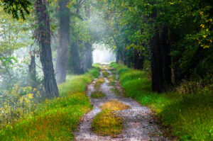
Mike Mitchell: I first visited the C&O Canal Park in 1975 when I moved to the Washington area for graduate school, running and cycling on the towpath when I had time away from studies.  I visited the Park with greater frequency beginning in 1992 when I became an adult leader in the Cub Scout and Boy Scout programs in the River Falls neighborhood in Potomac, with dozens of camping, cycling, and hiking events in the Park with the Scouts over the years.  In 1999 I began long distance cycling trips with friends on the towpath, and in the ensuing years have cycled on the towpath from Cumberland to DC five times and from Pittsburgh to DC twice.  In 2012 I was invited to join the Board of the C&O Canal Trust and for several years chaired the Program Committee of the Trust.  From 2014 through 2018 I chaired the Board of Directors of the Trust.  I am an avid photographer and six of my ten exhibits to date have featured images from the Park.  The Park continues to be my “go to” place for time in nature, peace and reflection, and I am in the Park on average three times a week.

C&O Canal Trust: During your time volunteering with the Trust, what is your favorite project you have been a part of?
Mike Mitchell: While it was not a “project” per se, my four years as Board Chairman of the Canal Trust provided me my fondest memories and sense of accomplishment in regard to the Park.  That experience afforded me a great opportunity to spend extensive time in the Park, attain a familiarity with the entire 184.5 miles of the Park, and to have a sense of legacy impact on my community adjacent to the Park as well as the entire span of the Park.  It also gave me the opportunity to develop a range of new friendships with fellow Board members, the incredibly dedicated Canal Trust staff, and the National Park Service leadership and staff of the C&O.  If I were to pick one favorite specific project on which I was a participant it would be the acquisition and installation of the new Marsden Bridge seen in the photography below.

C&O Canal Trust: Do you have a favorite canal memory?
Mike Mitchell: It would be impossible to select a single favorite canal memory.  I have a kaleidoscope of fond memories including cycling the length of the towpath multiple times with the Four Amigo friends from my days in the aerospace industry; hiking the entire length of the Park last September with a neighbor and current Canal Trust Board member in support of the Canal Trust mission; endless hours of photography in the Park in all seasons and all times of day; walks in the Park with fellow Canal Trust Board members; hiking, cycling, cross-country skiing, snowshoeing in the Park; staying on overnights in the Canal Quarters lock houses with friends and family; and the sense of mission and achievement in working with the Canal Trust Board and staff, and the National Park Service staff in support of the Park.

C&O Canal Trust: What is your favorite spot on the canal?
Mike Mitchell: My favorite spot on the canal is wherever I happen to be on the canal at that moment.  Then entire 184.5 miles of the Park is a celebration of nature.

C&O Canal Trust: What does the canal mean to you?
Mike Mitchell: I like to tell people that I have three sanctuaries in my life, Bethesda United Methodist Church, Washington Nationals Park, and the C&O Canal National Historical Park.  BUMC services are on YouTube and no fans in Nats Stadium now because of the pandemic, leaving the C&O Canal Park an ever more important place to spend time with friends, enjoy nature, to reflect and to recharge.  The C&O Canal Park is a place for adventure and discovery, but it also is a deeply spiritual place for me.    

C&O Canal Trust Announces Creation of Apparel Line in Partnership with Maryland-Based Route One Apparel

By News
March 1, 2021 – The C&O Canal Trust today announced the launch of a new C&O Canal-themed apparel line in partnership with Maryland-based company Route One Apparel to celebrate the 50th anniversary of the C&O Canal National Historical Park joining the National Park Service.

The initial collection features a short-sleeved t-shirt with a rendering of the scenic C&O Canal towpath on the back. The shirts will retail for $24.99, and a portion of the sale of each shirt will support the C&O Canal Trust’s mission to preserve and protect the C&O Canal National Historical Park. The Trust is the official nonprofit partner of the Park.

Read More

Meet Béla Demeter, Canal Steward

By Blog, Content, Volunteer

I’ve been a Canal Steward since July 2018. I’ve hiked the Canal and the Billy Goat Trail for nearly 50 years (when I came to Washington). I often had a plastic bag with me and rarely came out without some bottles and trash. It felt good to do my small part in cleaning up our shared landscape, especially when it involved so little effort. Signing on to the Canal Steward Program seemed like the next logical step.

In my 35 years as reptile keeper and Biologist at the National Zoo, I was the liaison between the department and our keeper aides and interpretive volunteers. I came to appreciate how incredibly important these folks were to the enhanced functioning of our operation. We simply couldn’t have reached out to the public as efficiently without their help. Upon retirement, I felt it was time to pay back some of that energy (my initial volunteer gig was at the National Gallery of Art as a docent, leading tours of the collection). As essential as government agencies are to the operation of parks and museums, staff are often limited by budgets and resources. Tapping into the immense pool of retirees and other people with time on their hands is an excellent way to enhance the benefits that these institutions offer. I also feel that it’s beneficial in so many ways when the public takes a proprietary interest in these areas.  

I think recruiting more volunteers (especially young ones) is money well spent. It always makes my day when young people comment on what I’m doing and remark that they have either done that themselves or are now inspired to do so in the future. I can spend every day on the canal, but it takes everybody pitching in to keep it pristine.

It’s difficult to pick a favorite spot in the Park — sorta like choosing your favorite child. Two spots on Billy Goat B come to mind, however. From an artistic point of view, there is a fallen tree about a quarter mile from the West trailhead. I call it the “Ent” (from Lord of the Rings). It’s incredibly expressive, and I always stop to gaze at it. It changes with moisture and is even more dramatic after a rain.

My other favorite area is about a half mile from the West trailhead. I call it “Skink Rock” due the numerous Five-lined Skinks that make this spot their refuge. It’s fun to find the little guys hiding in the crevices in the summer. This area also has a fair population of Pine Swifts as well as Black Racers on the upper portion of the trail.

Join Béla in becoming a Canal Steward this year! Sign up here.

Canal Story #8: Kari Cannistraro

By Canal Story

To celebrate the 50th anniversary of the C&O Canal becoming a National Historical Park, we are featuring 50 Canal Stories throughout 2021. Each story will take a look at a person’s relationship with the C&O Canal. Whether an NPS ranger, a volunteer, or a visitor, everyone has a story to tell about the canal! If you want to share your story, submit it to us at the link here, email it to us at [email protected] or post it on your social media feeds with the hashtag #MyCanalStory.

Tell Us Your Canal Story

Kari Cannistraro, Avid Canal Bike Rider & Vlogger

C&O Canal Trust: Tell us your canal story!

Kari: During the quarantine, I longed for some release. I craved the freedom to discover something new, explore hidden treasures, connect with nature, and engage in some fun exercise. Bike riding on the C&O Canal Towpath was the answer. I started planning each bike adventure as a tour with points of interest. Each tour would be about 20 miles to complete. As a videographer, I included my GoPro camera on these excursions. Thus began my new adventure creating videos to inspire more people to get out there and ride the C&O Canal Towpath Trail. Over time the bike touring made a profound change in my life.

Knowing that there were once Indians habituating right in this area sharpens my experience. I ride along the Potomac River on one side and the canal on the other side. I envision the mules pulling the boats through along the waterway and stopping at the lock gates to pass through the lock. I yell “Heeeey, Lock!” That is what the canal boater would yell to the lock keeper to open up the gates so as to pass through. As I ride along, I watch the trees sway in the wind with leaves splashing on the trail, feeling a kinship with the tranquil and of the stirring of nature drawing me in. I often pause off the bike trail and listen to the sounds of nature around me. I continue to ride along the Potomac River with the wind blowing through my hair just being in the moment. I let my mind wander and breathe in the pure air. I am in a gothic cathedral of trees. It’s a drug. I pass a historic marker that has a description of a Civil War battle crossing and a desperate escape. It really happened right here! I have to stop and take a closer look. Filming while rolling along and stopping at points of interest has intensified my experiences and my feelings of well-being. There is gold in “them thar hills”…yes…gold mines. I fight the rough hilly terrain feeling the thrill of danger to conquer it. I pass one of the most picturesque railroad depots and then quarry ruins that look like Roman ruins, but this is Maryland. On another trip, I push my bike off the path towards an 18th-century old village. Even though only stonewall ruins remain, it gives me a sense of adventure and travel. I feel as if I am on vacation. I need more! My goal is to continue to film my bike adventures and post them on YouTube and cover all of the 184.5 miles of the C&O Canal Towpath. I am biking the trail in segments and have already posted many videos. Each video has a travel destination to stop, enjoy and learn about the history surrounding the C&O Canal Towpath. There are hidden gems out there that enhance the biking experience. Besides various historic ruins, waterfalls, charming towns, gold mines, horse farms, ghosts, eagles, there is the ever-pervasive nature and wildlife. So many stories of interest are nestled nearby and often hidden along the trail. The C&O Canal Towpath is a wonder waiting to be discovered.

As I say at the end of all my videos…. “Hope to see you riding!”

Below are some of the C&O Towpath videos shot during the bike rides.
1.Lock 18 to Lock 23- Great Falls to Seneca Mill and Quarry Ruins
https://youtu.be/nzri5KVbrcs
2.Cabin John, Maryland to Georgetown, DC Lock 10 to Lock 5
https://youtu.be/x563f3aoG9I
3.Point of Rocks, MD to Harpers Ferry, WVA Lock 29 to Lock 33
https://youtu.be/si8ZClfKcOo
4.Harpers Ferry, WVA to Shepherdstown, WVA Lock 33 to Lock 38
https://youtu.be/q4T2Q5VdLsI

YouTube Channel: https://www.youtube.com/channel/UC3og6FPSbicKUUhhnJmgLGw

Canal Story #7: Bruce Rosenblum

By Canal Story

To celebrate the 50th anniversary of the C&O Canal becoming a National Historical Park, we are featuring 50 Canal Stories throughout 2021. Each story will take a look at a person’s relationship with the C&O Canal. Whether an NPS ranger, a volunteer, or a visitor, everyone has a story to tell about the canal! If you want to share your story, submit it to us at the link here, email it to us at [email protected] or post it on your social media feeds with the hashtag #MyCanalStory.

Tell Us Your Canal Story

Bruce Rosenblum, Frequent Canal Visitor

C&O  Canal Trust: Tell us your C&O Canal story!
Bruce: During the summer of 2020, I cleared my head and some got exercise by going for a brisk walk along the canal most mornings, as early as possible (usually starting by 6 a.m.) While I have travelled the canal by bike and foot for many years, being there regularly and at a time when there was not too much other “human activity,” I saw many things I had not noticed before–river otters building a den and traversing the space between canal and river; a great blue heron catching a frog for “breakfast”; two owls singing a “duet”. I wrote a song for my grandson (age 5) about the canal, and on a late August trip to visit him (my only sojourn away from the house in the last 10 months) had a chance to sing it with him and add a verse he wrote about his experiences with nature walking on Cape Cod. A version of the song is posted to You Tube, complete with photographic “illustrations” from some of my canal walks and you can view it here.

C&O Canal Trust: What is your relationship with the C&O Canal?
Bruce: I have visited the canal for many years, either as part of my bike routes or on foot.  Walking, biking and watching the views/wildlife are my favorite things to do there.  

 C&O Canal Trust: Do you have a favorite canal memory?
Bruce: I have many fond memories of being on the canal, but it has been extra special during the last 10 months to be able to access this natural beauty so close to home when travel is difficult to impossible.

C&O Canal Trust: What is your favorite spot on the canal?
Bruce: My walks center on the segment between Swains Lock and Seneca Lock (Swains Lock is 4-5 miles from my house), which has beautiful views and a fair amount of wildlife.  I have been on the path from the start in Georgetown to Edwards Ferry, and there are a lot of beautiful and varied spots along that (circa 30 mile?) section–but that also means I haven’t even seen most of the canal yet!

Canal Story #6: Daofeng and Angela He

By Canal Story

To celebrate the 50th anniversary of the C&O Canal becoming a National Historical Park, we are featuring 50 Canal Stories throughout 2021. Each story will take a look at a person’s relationship with the C&O Canal. Whether an NPS ranger, a volunteer, or a visitor, everyone has a story to tell about the canal! If you want to share your story, submit it to us at the link here, email it to us at [email protected] or post it on your social media feeds with the hashtag #MyCanalStory.

Tell Us Your Canal Story

Daofeng and Angela He, C&O Canal Trust Donors

Daofeng and Angela He, through their Daofeng and Angela Foundation, have sponsored 40 benches along the C&O Canal National Historical Park’s towpath, providing $185,000 to the C&O Canal Trust for park maintenance and beautification projects.

C&O Canal Trust: What is your relationship with the C&O Canal?
Daofeng & Angela: We live very close to the Park and always use the towpath and trails to walk and ride bikes. We feel we need to feed back into nature and national parks. People take more from nature then we feed back into it. That is the biggest challenge we as humans have to face. 

C&O Canal Trust: Why did you decide to sponsor benches along the C&O Canal towpath?

Angela: For me, nature is very important. People need to take care of nature. At Great Falls, we saw the boat and the people enjoying the Park. Every Friday, I went to the Park to walk along the Billy Goat Trail. I would sit on a rock, and it was very peaceful. People use the Park to leave behind their stressful lives and feel peaceful. In nature, everything is peaceful. For this reason, nature and the environment is very important to everyone. It is the small things that are important. In the community and in our families, we take care of the small things and this helps us to take care of the big things.

Daofeng: Before I retired, I was involved in establishing a nonprofit in China. So I know about the nonprofit industry. Here in the U.S. I wanted to sponsor a local nonprofit that worked at the grassroots level. I wanted to make the funds from my foundation to flow to where it is really needed. A bench is a symbol of how we can reconstruct the relationship between humans and nature. It is important that the benches are made of reconstructed materials. Nothing is destroyed to manufacture them. We think of each bench and its location as a microclimate in the Park.

C&O Canal Trust: What is your favorite spot on the canal?
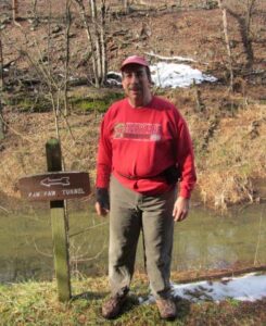
Daofeng & Angela: We enjoy hiking the towpath between Bethesda and Great Falls.

A Day in Williamsport, Maryland – An Itinerary

By Blog, Explore Your Park, Planning Your Visit, Things to Do, Towns and Communities

Park: You can get to the towpath from the town by bike or car when you head west on W. Potomac Street until you reach the Cushwa Basin parking lot. The towpath is located approximately 300 ft north west through the RailRoad Lift Bridge.    

River access: There are two entry points for boats along the Potomac River at River Bottom Park. The park can be accessed by bike or on foot from the towpath 0.9-miles. west of Lockhouse 44. For car access to the boat ramp, make a right onto N. Commerce St from W. Potomac St heading east out of the Cushwa Basin parking lot. Then make a right onto W. Salisbury Street to cross the Bollman Bridge. Follow this path down 0.1-miles to reach the boat access point. The second access point is located 600 ft to the right of the bridge overpass.

Stay: Depending on your preference, Williamsport offers a variety of lodging options. If you are interested in staying close to the towpath Bay farms, Bed and Breakfast is two blocks down W. Salisbury Street, totaling 0.5- mi. It offers an ideal stop for overnight travelers, hikers, or cyclists. Red Roof Inn is located a short distance, 1.1-mi from the towpath on E. Potomac Street, and provides affordable economy lodging choices. Another overnight stay option is Elmwood Farm Bed and Breakfast, which showcases cozy rooms and historic barn settings. Two miles up the towpath heading north is Jordan Junction Campground. An excellent place for hikers and bikers on the move; portable water, toilets, picnic tables, and grills are available for use. For extensive overnight camping Safari Campground and Yogi Bears, Jellystone Park Resort reside at the cross-section of Kendle and Lappans Rd. Cabin rentals, tent sites, and water amenities are available at the camp resort. 

Cushwa Basin by Mark Crilley

Williamsport Aqueduct by John Gensor

Don’t Miss: The RailRoad Lift Bridge & Conococheague Aqueduct.

The Conococheague Aqueduct is an exciting access point for canal boat riders interested in the full canal experience. Since the permanent lifting of the RailRoad Lift Bridge in 2016, pedestrians have been given access to cross the canal through the bridge. The restoration allowed for the expansion of the canal boat tour. The launch boat ride now explores the full length, from the Cushwa Basin to Lockhouse 44, with an informative historical tour of the canal. The tour also includes the newly restored Conococheague Aqueduct, which allows for boat operations to continue. This area is the, “Only place in North America where visitors can view, an operational lift lock, railroad lift bridge, lockhouse, turning basin and warehouse. (NPS, Conococheague Aqueduct 2020)”  

Eat: Dessert Rose Cafe 

Desert Rose Cafe is located a convenient two blocks from the towpath, heading east on W. Potomac for 0.3 miles. The restaurant provides a relaxed space for those eating in and hikers, bikers, and pedestrians on the go. Bike racks, outdoor seating, and amenities for trail users are available, such as bike pumps, inner tubes, first aid, and more. 

Chill: Byron Memorial Park

Byron Memorial Park is a brisk 0.8 miles from the towpath and leads into the center of town. This is a multiuse park that is located at the interaction of E Potomac St and Park Rd. Byron Memorial Park is known for its eventful celebrations encompassing car shows, concerts, and elaborate holiday celebrations such as Christmas lights and Fourth of July displays. Besides festivals, the park offers different facility rentals for those interested in using the Williamsport Community Building, pavilions, bandstand, gazebo rentals, and other rentals advertised on the Williamsport Town website.   

If you have time: Visit Lockhouse 44 

Located at mile marker 99.1 on the towpath, Lockhouse 44 stands along the canal. It was built in 1834 out of white and gray limestone; it now serves as a historical exhibit for requested tours. It is one of few surviving Lockhouse’s that initially maintained and operated the boat-locking system along the canal. 

Come back for: Springfield Farm

Springfield Farm is perfect for history fanatics interested in following the rich history of Williamsport. The Springfield farm is one of the largest barns in Maryland built by Otho Holland Williamsport himself in 1755. The estate contains a museum, two four bays, and a participant of the Living Legacy Project, an initiative dedicated to the 150th Anniversary of the Civil War and the fallen soldiers. Although the property is commemorated for its historical contributions, it is also available for reception, community events, fundraisers, banquets, and more. Questions can be directed to their email [email protected] or phone number listed on the website.  

Events: Fourth of July Fireworks Display 

If fun and exciting celebrations are what you are looking for, join Williamsport in celebrating Independence day at Byron Memorial Park. It is a free venue that provides live local music performances, vendors, and a grand firework display.  

Along the Towpath in Williamsport by Ed Crawford

A Day in Poolesville, Maryland – An Itinerary

By Blog, Explore Your Park, Planning Your Visit, Things to Do

Parking access: Poolesville is located about five miles from the C&O Canal National Historical Park. To get to the Park from the Old Town Bank Museum located on Fisher Avenue in Poolesville, head west on Fisher Avenue and make a left onto W. Willard Rd. Make a right onto Westerly Road in approximately 1.4 miles. You will then make a left onto Edwards Ferry’s Rd and continue until the end of the road. There is a small parking lot available for day and overnight parking located here. 

River access: Edward’s Ferry boat ramp access is located at the end of Edward’s Ferry Road, past Lockhouse 25. This is a historic Civil War site used by the Union Army for crossing the Potomac River. This area is known for smallmouth bass fishing.

Where to stay: Poolesville is home to Lockhouse 25. A blast from the past, this rustic lockhouse can be reserved through the Canal Quarters program. This historic structure was built in the 1830s and sits at mile marker 30.9 on the towpath. It is available for overnight stays by up to eight guests. 3.7 miles upstream from the towpath, is Turtle Run hiker/biker campsite. It includes a water pump, a portable toilet, and a picnic table & grill.

Sunflower Field located at Sycamore Landing Road (mile marker 27), Poolesville, Maryland. by Nicholas Clements

Civil War Reenactment at Lockhouse 25 by Jan Branscome

Don’t miss: The John Poole House

Originally built in 1793 as a log store, the John Poole House is the oldest building in Poolesville. It served as Poolesville’s first Post Office in the early nineteenth century and is now the Historic Medley District office. This historic building is located behind The Old Bank/ Old City Hall of Poolesville.

Where to eat: Poolesville Athletic Club & Cafe 107

Café 107 is located in the Poolesville Athletic Club and offers a wide selection of both hot and cold drinks, such as blended coffee drinks, smoothies, and food such as grilled chicken wraps, pizza, and even tasty breakfast dishes, which are available all day. It doesn’t get much better than that!

Where to chill: Whalen Commons

Whalen Commons, located in the town center, is a place to meet and greet new and old friends alike. Enjoy outdoor concerts, farmer’s markets, and outdoor movie nights in the open grassy area, . You will also find restrooms, a bandshell and a walking trail here.

If you have time: McKee Beshers Wildlife Management Area

McKee-Beshers is known for its deliberately flooded forests during the fall and winter. Biologists create these “greentree reservoirs” to attract colorful wood ducks and other waterfowl that migrate through or spend the winters here. Along the preserve’s many miles of trails, you can also spy more than 200 species of songbirds and other wildlife such as deer, wild turkey, reptiles and amphibians.

Come back for: Sugarloaf Mountain overlook

This registered National Landmark has a breathtaking view and is accessible for bikers and hikers on the towpath. This is about a 10– mile bike ride from or 15mins by car from White’s Ferry. from Poolesville and 17 mins from Whites Ferry. The park is open 8 a.m to sunset. Gates close one hour before sunset.

Events: Violettes Lock and Stroll 5k October 21, 2023 @ 11 a.m.

Join us in Poolesville to walk, run, or stroll among the beautiful fall foliage along the towpath, while also supporting the Park. Following the 5k, we invite our canal community to celebrate the completion of this year’s TowpathGO challenge at Rocklands Farm Winery.

Bassett’s Public Art Mural by Trust Staff

https://www.visitloudoun.org/listing/whites-ferry/56/https://www.poolesvillemd.gov/338/Whites-Ferryhttps://www.canaltrust.org/pyv/whites-ford/http://sugarloafmd.com/https://www.poolesvilleday.com/about-ushttps://www.poolesvillemd.gov/facilities/facility/details/Whalen-Commons-8