
Echoes of an Industry
By Ranger Hollie
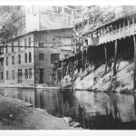
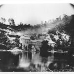
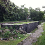
The first time I biked past the ruins of Round Top Cement Mill, I dismounted and gazed up at it in amazement. There is nothing else like it on the canal. Most striking to me is how, after all this time of idle decay, the cement mill ruins remain quite impressive. It easily captures my imagination and leads me to contemplate what this booming industry, in this now quiet stretch of the canal, must have looked like in its heyday.
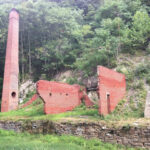
Like other businesses along the canal, Round Top Cement Mill opened as a result of canal construction. In the 1830s, while excavating near Roundtop Hill, canal laborers discovered limestone, a key ingredient for cement. Having the ability to manufacture cement close to the job site was hugely beneficial to the canal company; therefore, in 1838, the C&O Canal Company authorized George Shafer to mine limestone and construct a cement mill.
Over the next twenty-five years, the cement mill provided cement for the remaining sixty miles of canal heading west to Cumberland, producing over 200,000 bushels of cement! Cement was packaged into barrels and sacks and shipped downstream by both the C&O Canal and the B&O Railroad.
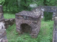
The mill changed owners in 1863, and was renamed the "Round Top Hydraulic Cement Company." It continued as a booming industry, averaging 2,100 barrels of hydraulic cement per week, making it one of Washington County's most profitable businesses. Over 100 local workers operated the mill, which included a 16-foot-diameter overshot waterwheel, four pairs of grind stones, and eight coal-fired cement kilns. Cement from Roundtop was used all over the area, including in the foundation of the Capitol Building in Washington, D.C.
Advances in technology and industry in the 20th century soon made many companies obsolete, including the Round Top Cement Mill. The plant closed its doors in 1909 after the development of Portland Cement, a slower drying and more durable material.
Standing in front of the cement mill ruins today, it does not seem like over a hundred years has past. Although the landscape has changed and the people are gone, the mill ruins still echo with signs of past commerce, prosperity, hard labor, and industry.


Lock 52
Milepost 122.7
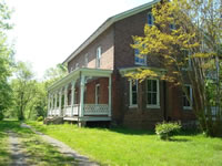
Bowles House Visitor Center
Milepost 123
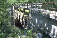
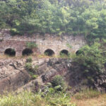
Tonoloway Creek Aqueduct
Milepost 123
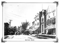
Town of Hancock
Milepost 124.1

Little Tonoloway Recreation Area
Milepost 124.4
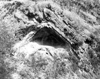
Devil's Eyebrow
Milepost 127.2

Western Maryland Rail Trail
Milepost 112